Skip to search
Skip to main content
Digital Commonwealth
Sign Up / Log In
Search for
Search
Search
Search
Basic
Advanced
Explore
Map
Collections
Institutions
Formats
For Educators
Primary Source Sets
Lesson Plans
Using Primary Sources
Searching Digital Commonwealth
For Institutions
Join Digital Commonwealth
Conferences, Trainings, & Events
How to Contribute Collections
Digitization Services
Board & Committees
Frequently Asked Questions
About
About Digital Commonwealth
News & Announcements
Copyright & Terms of Use
Harmful Content Statement
Partners
API
Contact Us
Boston Public Library
Norman B. Leventhal Map Center Collection
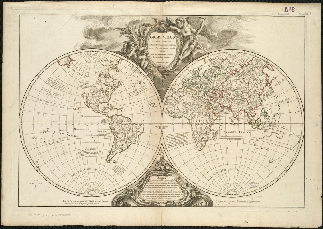
Orbis vetus in utrâque continente juxtà mentem Sansonianam distinctus, nec non observationibus astronomicis
Orbis vetus in utrâque continente juxtà mentem Sansonianam distinctus, nec non observationibus astronomicis
×
Item Information
Title:
Orbis vetus in utrâque continente juxtà mentem Sansonianam distinctus, nec non observationibus astronomicis
Creator:
Robert de Vaugondy, Didier, 1723-1786
Name on Item:
redactus, accurante Robert de Vaugondy, geographo regis ordinario.
Date:
1752
Format:
Maps/Atlases
Location:
Boston Public Library
Norman B. Leventhal Map Center
Collection (local):
Norman B. Leventhal Map Center Collection
Subjects:
World maps--Early works to 1800
Places:
World
Extent:
1 map ; 2 hemispheres each 35 cm. in diameter, on sheet 56 x 79 cm.
Permalink:
https://ark.digitalcommonwealth.org/ark:/50959/2514p072r
Terms of Use:
No known copyright restrictions.
No known restrictions on use.
Publisher:
Lutetiae Parisiorum : apud autorem ... et apud Ant. Boudet ...
Scale:
Scale [ca. 1:36,666,666]
Language:
Latin
Notes:
Relief shown pictorially.
Scale determined by using graticule method, measured at 10⁰ north.
Identifier:
06_01_005936
Call #:
G3200 1752.2 .R6
Barcode:
39999059018687
show more...
View MODS XML
More Like This
Carta universal en que se contiene todo lo que del mundo se ha ...
Chart of the track of the Dolphin, Tamar, Swallow & Endeavour ...
Chart of the world according to Mercators projection, shewing the ...
A chart of the world upon Mercator's projection : describing the ...
Find More Like This >>
Tools
Share
Facebook
Pinterest
X
Reddit
Tumblr
Email
Copy link
Add to Folder
Questions/Comments
Cite This Item
IIIF Manifest
Downloads
Primary (full resolution, uncompressed)
(TIF, 162 MB)
Large (full resolution)
(JPEG, 13.6 MB)
Medium
(JPEG, 351 KB)