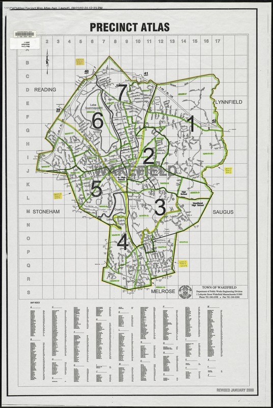
Revised January 2000.
Map depicts entire town of Wakefield in 2000, showing the seven voter precincts, as well as streets, school locations, and highway exit numbers. The map is hand-colored to show U.S. Census 2000 geography. Census tract boundaries are outlined in yellow, and census block groups are outlined in green.