Skip to search
Skip to main content
Digital Commonwealth
Sign Up / Log In
Search for
Search
Search
Search
Basic
Advanced
Explore
Map
Collections
Institutions
Formats
For Educators
Primary Source Sets
Lesson Plans
Using Primary Sources
Searching Digital Commonwealth
For Institutions
Join Digital Commonwealth
Conferences, Trainings, & Events
How to Contribute Collections
Digitization Services
Board & Committees
Frequently Asked Questions
About
About Digital Commonwealth
News & Announcements
Copyright & Terms of Use
Harmful Content Statement
Partners
API
Contact Us
Boston Public Library
Norman B. Leventhal Map Center Collection
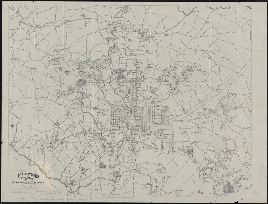
Flamm's new map of Baltimore and vicinity
Flamms new map of Baltimore and vicinity
×
Item Information
Title:
Flamm's new map of Baltimore and vicinity
Creator:
Dollenberg, Frederick D.
Name on Item:
compiled from official surveys by Frederick D. Dollenberg, County Surveyor of Balto. Co.
Date:
1916
Format:
Maps/Atlases
Location:
Boston Public Library
Norman B. Leventhal Map Center
Collection (local):
Norman B. Leventhal Map Center Collection
Subjects:
Baltimore (Md.)--Maps
Places:
Baltimore Independent City (county)
>
Baltimore
Extent:
1 map ; 54 x 68 cm.
Permalink:
https://ark.digitalcommonwealth.org/ark:/50959/4m90f440b
Terms of Use:
No known copyright restrictions.
No known restrictions on use.
Publisher:
Baltimore, Md : Wm. A. Flamm & Co.
Scale:
Scale [ca. 1:46,000]
Language:
English
Identifier:
06_01_010877
Call #:
G3844.B2 1916 .D65
Barcode:
39999065679845
show more...
View MODS XML
More Like This
Map City of Baltimore
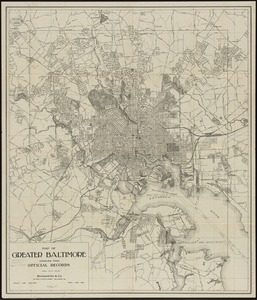
Map of greater Baltimore, compiled from official records : area ...
The 100th anniversary map of Abraham Lincoln's visit to ...
1630 shoreline
Find More Like This >>
Tools
Share
Facebook
Pinterest
X
Reddit
Tumblr
Email
Copy link
Add to Folder
Questions/Comments
Cite This Item
IIIF Manifest
Downloads
Primary (full resolution, uncompressed)
(TIF, 172 MB)
Large (full resolution)
(JPEG, 14.4 MB)
Medium
(JPEG, 301 KB)