Skip to search
Skip to main content
Digital Commonwealth
Sign Up / Log In
Search for
Search
Search
Search
Basic
Advanced
Explore
Map
Collections
Institutions
Formats
For Educators
Primary Source Sets
Lesson Plans
Using Primary Sources
Searching Digital Commonwealth
For Institutions
Join Digital Commonwealth
Conferences, Trainings, & Events
How to Contribute Collections
Digitization Services
Board & Committees
Frequently Asked Questions
About
About Digital Commonwealth
News & Announcements
Copyright & Terms of Use
Harmful Content Statement
Partners
API
Contact Us
Boston Public Library
Norman B. Leventhal Map Center Collection
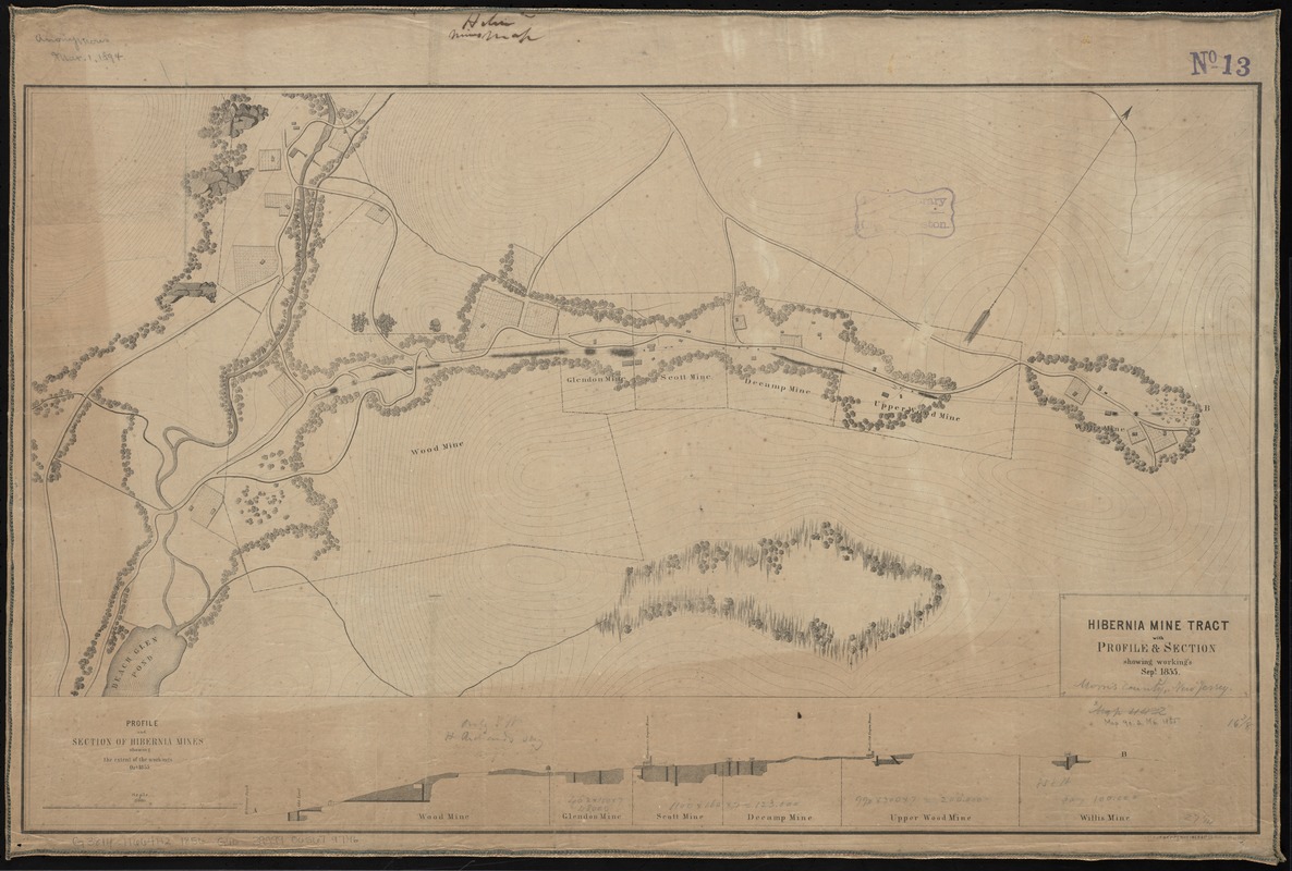
Hibernia mine tract : with profile & section showing working's Sept. 1855
Hibernia mine tract
×
Item Information
Title:
Hibernia mine tract : with profile & section showing working's Sept. 1855
Creator:
Geological Survey of New Jersey
Date:
[1856]
Format:
Maps/Atlases
Location:
Boston Public Library
Norman B. Leventhal Map Center
Collection (local):
Norman B. Leventhal Map Center Collection
Subjects:
Hibernia Iron Works (Hibernia, N.J.)--Maps
Iron mines and mining--New Jersey--Hibernia--Maps
Geology--New Jersey--Hibernia--Maps
Hibernia (N.J.)--Maps
Places:
Morris (county)
>
Hibernia
Extent:
1 map ; 43 x 71 cm.
Permalink:
https://ark.digitalcommonwealth.org/ark:/50959/4m90f449t
Terms of Use:
No known copyright restrictions.
No known restrictions on use.
Publisher:
Trenton, N.J : Geological Survey of the State of New Jersey
Scale:
Scale [ca. 1:2,600]
Language:
English
Notes:
Relief shown by form lines.
Includes inset, "Profile and section of Hibernia mines showing the extent of workings, Oct. 1855."
From: Annual report of the Geological Survey of the State of New Jersey. 2nd (1855). Trenton, 1856.
Notes (date):
This date is inferred.
Identifier:
06_01_010897
Call #:
G3814.H664H2 1856 .G46
Barcode:
39999065679746
show more...
View MODS XML
More Like This
The 100th anniversary map of Abraham Lincoln's visit to ...
1630 shoreline
1879. Progress map of the U.S. Geographical Surveys west of the ...
1903 Map of Salem and surrounding places
Find More Like This >>
Tools
Share
Facebook
Pinterest
X
Reddit
Tumblr
Email
Copy link
Add to Folder
Questions/Comments
Cite This Item
IIIF Manifest
Downloads
Primary (full resolution, uncompressed)
(TIF, 149 MB)
Large (full resolution)
(JPEG, 12.5 MB)
Medium
(JPEG, 269 KB)