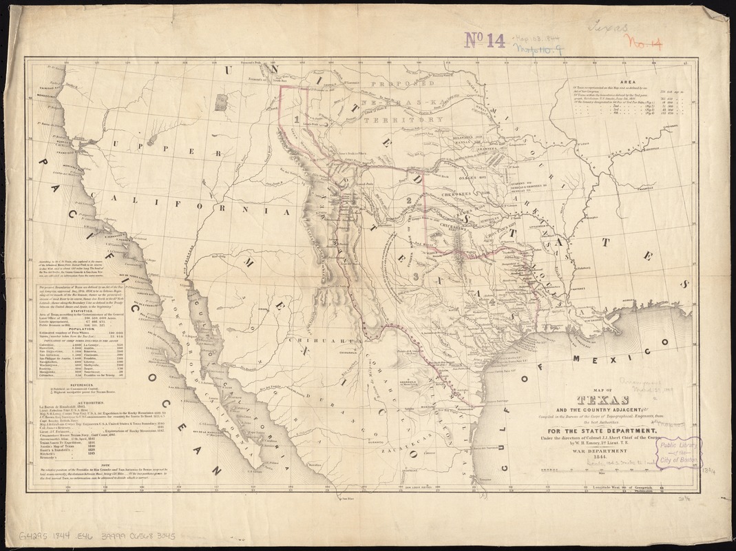
compiled in the Bureau of the Corps of Topographical Engeneers [sic], from the best authorities, for the State Department, under the direction of Col. J.J. Abert, Chief of the Corps, by W.H. Emory, 1st Lieut. T.E.
Relief shown by hachures.
Shows Indian tribes and various routes, including "Pike's Route," "Long's Route," "Gregg's Route in 1840," and "Road to Santa Fé laid out in 1825."
Prime meridians: Greenwich and Washington.
Includes text, statistics, and list of population.