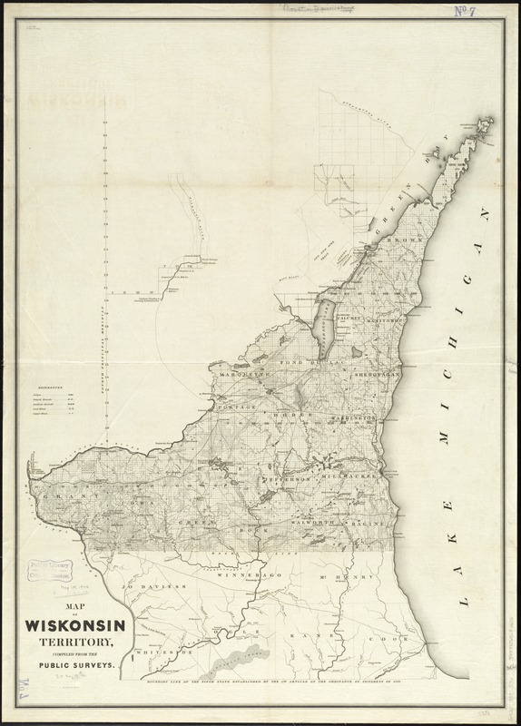
Covers primarily southern Wisconsin, south of the Wisconsin and Fox Rivers, up through the Door Peninsula; includes selected areas north of the Wisconsin and Fox Rivers; includes a portion of northern Illinois in less detail.
Shows public land survey sections, counties, towns, Indian reservations, lead mines, copper mines, lakes, rivers, roadways, canals, ledges, natural mounds, and artificial mounds.
Southern boundary of map is "Boundary line of the fifth state established by the 5th article of the ordinance of Congress of 1787."