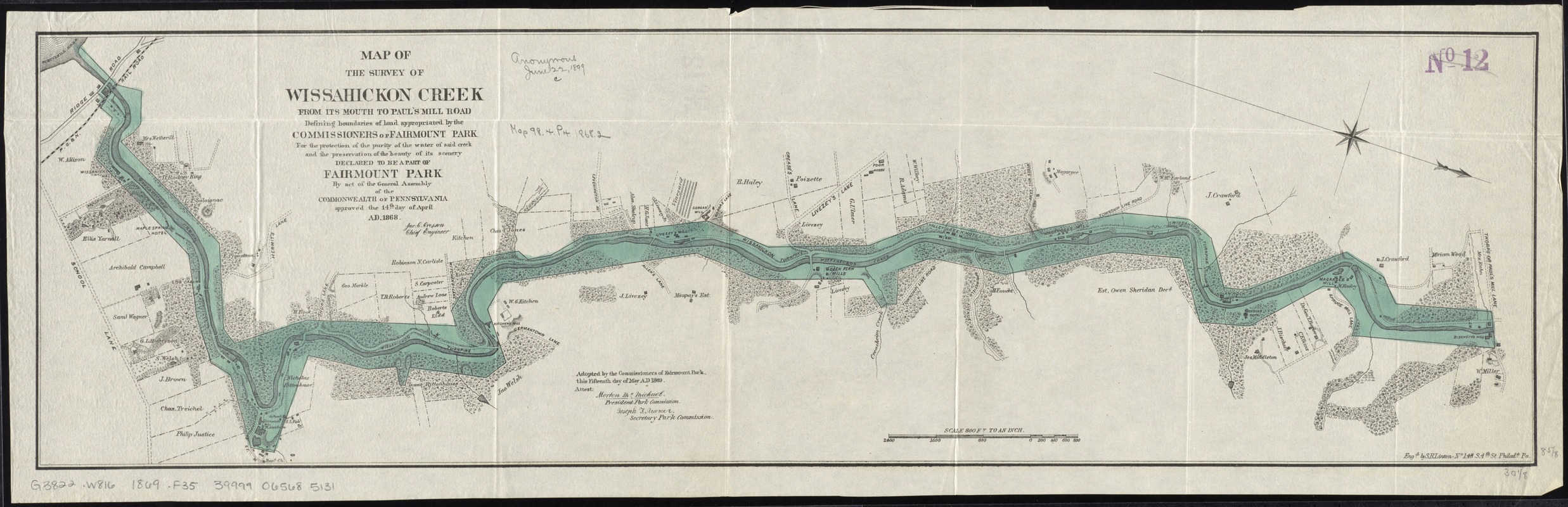
Map of the survey of Wissahickon Creek from its mouth to Paul's Mill Road defining boundaries of land appropriated by the Commissioners of Fairmount Park : for the protection of the purity of the water of said creek and the preservation of the beauty of its scenery declared to be a part of Fairmount Park by act of the General Assembly of the Commonwealth of Pennsylvania approved the 14th day of April AD. 1868
Map of the survey of Wissahickon Creek from its mouth to Pauls Mill Road defining boundaries of land appropriated by the Commissioners of Fairmount Park
Item Information
Title:
Map of the survey of Wissahickon Creek from its mouth to Paul's Mill Road defining boundaries of land appropriated by the Commissioners of Fairmount Park : for the protection of the purity of the water of said creek and the preservation of the beauty of its scenery declared to be a part of Fairmount Park by act of the General Assembly of the Commonwealth of Pennsylvania approved the 14th day of April AD. 1868
Relief shown by hachures.
Oriented with north towards the lower right.
"Adopted by the Commissioners of Fairmount Park, this fifteenth day of May A.D. 1869."
Also shows owners of adjacent property.