Skip to search
Skip to main content
Digital Commonwealth
Sign Up / Log In
Search for
Search
Search
Search
Basic
Advanced
Explore
Map
Collections
Institutions
Formats
For Educators
Primary Source Sets
Lesson Plans
Using Primary Sources
Searching Digital Commonwealth
For Institutions
Join Digital Commonwealth
Conferences, Trainings, & Events
How to Contribute Collections
Digitization Services
Board & Committees
Frequently Asked Questions
About
About Digital Commonwealth
News & Announcements
Copyright & Terms of Use
Harmful Content Statement
Partners
API
Contact Us
Boston Public Library
Norman B. Leventhal Map Center Collection
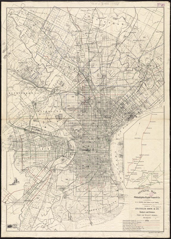
Official map of the Philadelphia Rapid Transit Co
Official map of the Philadelphia Rapid Transit Co
×
Item Information
Title:
Official map of the Philadelphia Rapid Transit Co
Creator:
Philadelphia Rapid Transit Company
Name on Item:
as furnished by W.S. Twining, chief engineer of the company.
Date:
1904
Format:
Maps/Atlases
Location:
Boston Public Library
Norman B. Leventhal Map Center
Collection (local):
Norman B. Leventhal Map Center Collection
Subjects:
Philadelphia Rapid Transit Company--Maps
Local transit--Pennsylvania--Philadelphia--Maps
Local transit--Pennsylvania--Philadelphia Metropolitan Area--Maps
Railroads--Pennsylvania--Philadelphia--Maps
Railroads, Elevated--Pennsylvania--Philadelphia--Maps
Subways--Pennsylvania--Philadelphia--Maps
Philadelphia (Pa.)--Maps
Philadelphia Metropolitan Area (Pa.)--Maps
Places:
Philadelphia (county)
>
Philadelphia
Extent:
1 map : col. ; 104 x 75 cm.
Permalink:
https://ark.digitalcommonwealth.org/ark:/50959/4m90fd34v
Terms of Use:
No known copyright restrictions.
No known restrictions on use.
Publisher:
Philadelphia, Pa : Chandler Bros. & Co.
Scale:
Scale [ca. 1:21,000]
Language:
English
Notes:
Oriented with north towards the upper left.
Distance from City Hall show by concentric circles.
Base map copyrighted by J.L. Smith, 1904.
Inset: [Transportation outline of area to the north].
Identifier:
06_01_011496
Call #:
G3824.P5P1 1904 .P45
Barcode:
39999065685032
show more...
View MODS XML
More Like This
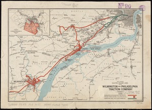
Map showing electric railway lines of the Wilmington and ...
Carte générale des États-Unis de l'Amérique avec les plans des ...
The city of New York as laid out by the Commissioners with the ...
Cyclists' road map of the Philadelphia District
Find More Like This >>
Tools
Share
Facebook
Pinterest
X
Reddit
Tumblr
Email
Copy link
Add to Folder
Questions/Comments
Cite This Item
IIIF Manifest
Downloads
Primary (full resolution, uncompressed)
(TIF, 96.3 MB)
Large (full resolution)
(JPEG, 8.09 MB)
Medium
(JPEG, 233 KB)