Skip to search
Skip to main content
Digital Commonwealth
Sign Up / Log In
Search for
Search
Search
Search
Basic
Advanced
Explore
Map
Collections
Institutions
Formats
For Educators
Primary Source Sets
Lesson Plans
Using Primary Sources
Searching Digital Commonwealth
For Institutions
Join Digital Commonwealth
Conferences, Trainings, & Events
How to Contribute Collections
Digitization Services
Board & Committees
Frequently Asked Questions
About
About Digital Commonwealth
News & Announcements
Copyright & Terms of Use
Harmful Content Statement
Partners
API
Contact Us
Boston Public Library
Norman B. Leventhal Map Center Collection
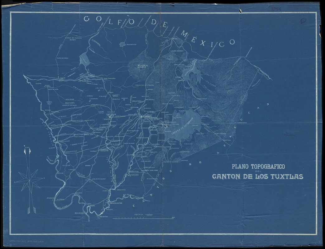
Plano topografico del canton de Los Tuxtlas
Plano topografico del canton de Los Tuxtlas
×
Item Information
Title:
Plano topografico del canton de Los Tuxtlas
Date:
[1900?–1909?]
Format:
Maps/Atlases
Location:
Boston Public Library
Norman B. Leventhal Map Center
Collection (local):
Norman B. Leventhal Map Center Collection
Subjects:
Veracruz-Llave (Mexico : State)--Maps
Tuxtlas Region (Mexico)--Maps
Places:
Veracruz
Extent:
1 map ; 73 x 101 cm
Permalink:
https://ark.digitalcommonwealth.org/ark:/50959/4m90fj499
Terms of Use:
No known copyright restrictions.
No known restrictions on use.
Publisher:
[Place of publication not identified] : [publisher not identified]
Scale:
Scale 1:100,000
Language:
Spanish
Notes:
Blueprint.
Relief shown by hachures.
Identifier:
06_01_011787
Call #:
G4540 1900 .P53
Barcode:
39999065690909
show more...
View MODS XML
More Like This
The 100th anniversary map of Abraham Lincoln's visit to ...
1630 shoreline
1879. Progress map of the U.S. Geographical Surveys west of the ...
1903 Map of Salem and surrounding places
Find More Like This >>
Tools
Share
Facebook
Pinterest
X
Reddit
Tumblr
Email
Copy link
Add to Folder
Questions/Comments
Cite This Item
IIIF Manifest
Downloads
Primary (full resolution, uncompressed)
(TIF, 165 MB)
Large (full resolution)
(JPEG, 13.9 MB)
Medium
(JPEG, 205 KB)