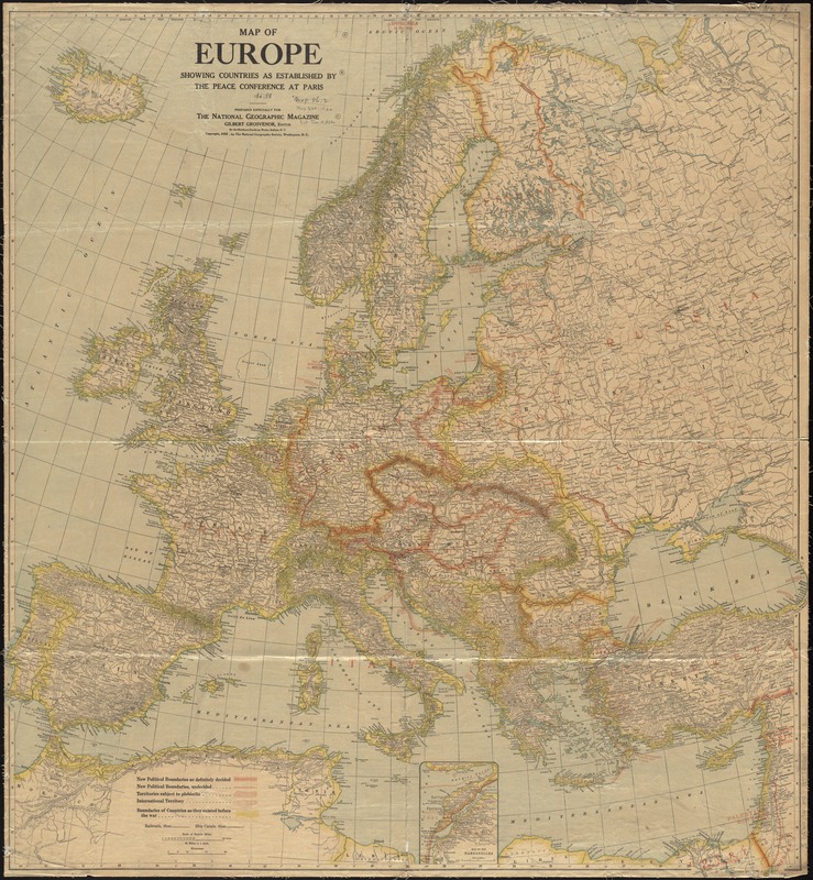
Map of Europe showing countries as established by the Peace Conference at Paris
Map of Europe showing countries as established by the Peace Conference at Paris
Item Information
Title:
Map of Europe showing countries as established by the Peace Conference at Paris
Description:
Shows boundaries of countries as they existed before the war, new political boundaries definitely decided by the conference, new political boundaries still under consideration, territories subject to plebiscite, and international territories. Protectorates and Mandates are shown.
Relief shown with hachures.
Issued with the National geographic magazine, Feb. 1921.
Includes inset of Map of the Dardanelles, scale approximately 1:1,000,000.