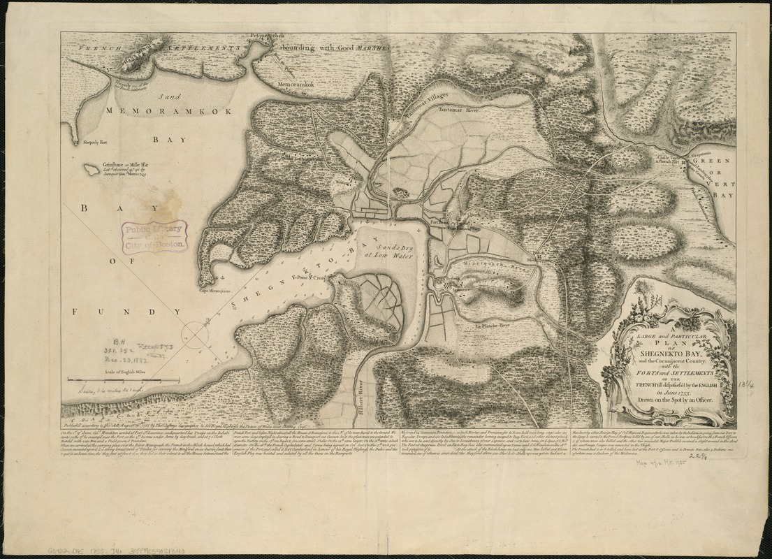
A large and particular plan of Shegnekto Bay, and the circumjacent country, with the forts and settlements of the French 'till dispossess'd by the English in June 1755
A large and particular plan of Shegnekto Bay, and the circumjacent country, with the forts and settlements of the French till dispossessd by the English in June 1755
Item Information
Title:
A large and particular plan of Shegnekto Bay, and the circumjacent country, with the forts and settlements of the French 'till dispossess'd by the English in June 1755
Relief shown by hachures. Depths shown by soundings.
Oriented with north toward the upper right.
Appears in Jefferys' General topography of North America and the West Indies. London: Printed for Robert Sayer, ... and Thomas Jefferys, 1768.
Cataloging, conservation, and digitization made possible in part by The National Endowment for the Humanities: Exploring the human endeavor.
![[Chignecto Bay and vicinity]](https://bpldcassets.blob.core.windows.net/derivatives/images/commonwealth:9g54xk66m/image_thumbnail_300.jpg)


