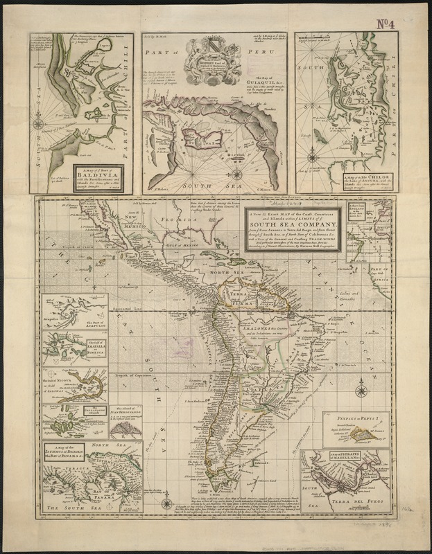
A new & exact map of the coast, countries and islands within ye limits of ye South Sea Company, from ye river Aranoca to Terra del Fuego, and from thence through ye South Sea, to ye north part of California &c. with a view of the general and coasting trade-winds : and perticular draughts of the most important bays, ports &c. according to the newest observations
A new & exact map of the coast, countries and islands within ye limits of ye South Sea Company, from ye river Aranoca to Terra del Fuego, and from thence through ye South Sea, to ye north part of California &c. with a view of the general and coasting trade-winds
Item Information
Title:
A new & exact map of the coast, countries and islands within ye limits of ye South Sea Company, from ye river Aranoca to Terra del Fuego, and from thence through ye South Sea, to ye north part of California &c. with a view of the general and coasting trade-winds : and perticular draughts of the most important bays, ports &c. according to the newest observations
Relief shown pictorially.
Insets: A chart from England to the river Aranoca &c. -- Peypses or Pepys I. -- A map of ye Straits of Magellan &c. -- A map of the isthmus of Darien the bay of Panama &c. -- The island of Juan Ferdinando -- The Gallapagos Islands -- The gulf of Nicoya or gulf of Salinas -- The gulf of Amapalla or Fonesca -- The port of Acapulco.
Ancillary maps: A map of ye port of Baldivia with the fortifications and islands &c. -- The bay of Guiaquil &c. -- A map of the isle Chiloe, the lake of Ancuna, with the islands &c.
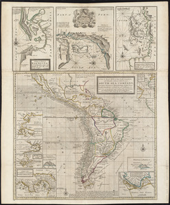
Copy 2 is plate 12 in Moll's The world described, [1709-1736].
Cataloging, conservation, and digitization made possible in part by The National Endowment for the Humanities: Exploring the human endeavor.