Skip to search
Skip to main content
Digital Commonwealth
Sign Up / Log In
Search for
Search
Search
Search
Basic
Advanced
Explore
Map
Collections
Institutions
Formats
For Educators
Primary Source Sets
Lesson Plans
Using Primary Sources
Searching Digital Commonwealth
For Institutions
Join Digital Commonwealth
Conferences, Trainings, & Events
How to Contribute Collections
Digitization Services
Board & Committees
Frequently Asked Questions
About
About Digital Commonwealth
News & Announcements
Copyright & Terms of Use
Harmful Content Statement
Partners
API
Contact Us
Boston Public Library
Norman B. Leventhal Map Center Collection
/
Boston and New England Maps (Collection of Distinction)
Map of Plymouth County, Massachusetts
Map of Plymouth County, Massachusetts
×
Item Information
Title:
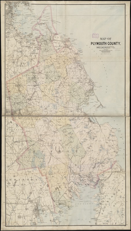
Map of Plymouth County, Massachusetts
Creator:
Geo. H. Walker & Co
Date:
[ca. 1891]
Format:
Maps/Atlases
Location:
Boston Public Library
Norman B. Leventhal Map Center
Collection (local):
Norman B. Leventhal Map Center Collection
Subjects:
Plymouth County (Mass.)--Maps
Places:
Plymouth (county)
Extent:
1 map : col. ; 143 x 77 cm.
Permalink:
https://ark.digitalcommonwealth.org/ark:/50959/9s161931v
Terms of Use:
No known copyright restrictions.
No known restrictions on use.
Publisher:
Boston, Mass : Geo. H. Walker & Co.
Scale:
Scale 1:63,360.
Language:
English
Notes:
Relief shown by spot heights.
Identifier:
06_01_003247
Call #:
G3763.P5 1891 .W3
Barcode:
39999058999739
show more...
View MODS XML
More Like This
Highway map of Plymouth County, Massachusetts : prepared for the ...
Map of Plymouth County, Mass.
Map of the county of Plymouth, Massachusetts : from actual surveys ...
New topographical atlas of surveys Plymouth County, together with ...
Find More Like This >>
Tools
Share
Facebook
Pinterest
X
Reddit
Tumblr
Email
Copy link
Add to Folder
Questions/Comments
Cite This Item
IIIF Manifest
Downloads
Primary (full resolution, uncompressed)
(TIF, 329 MB)
Large (full resolution)
(JPEG, 27.7 MB)
Medium
(JPEG, 162 KB)