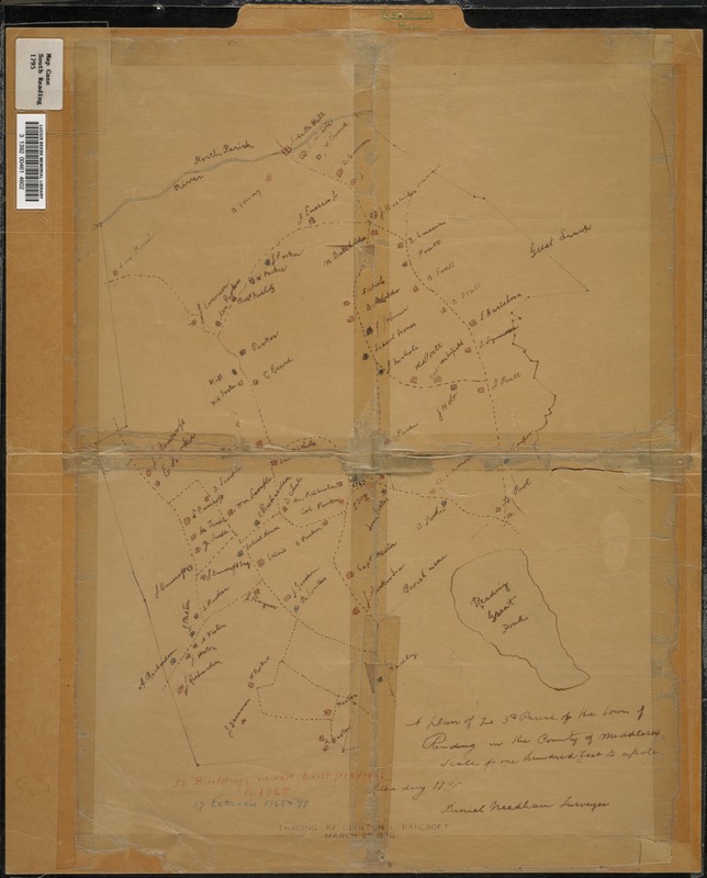
Map depicts Reading from the Ipswich River south to the Great Reading Pond (i.e., Lake Quannapowitt) in 1795, showing roads, houses, and property owners. It is a 1930 tracing of an original by Daniel Needham, surveyor. A note reads "Scale of one hundred feet to a pole"