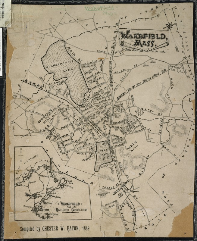
Map depicts entire town of Wakefield in the 1890s, showing streets, bodies of water, and hills. An inset map depicts Wakefield's railroad connections to Boston and northeastern Massachusetts.
Notes (date):
"Compiled by Chester W. Eaton, 1889." -- Text from map.