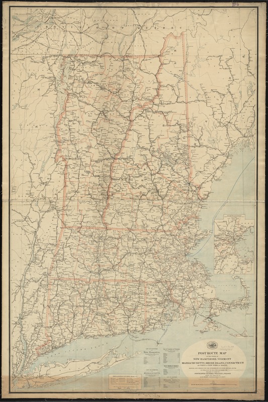
Post route map of the states of New Hampshire, Vermont, Massachusetts, Rhode Island, Connecticut and parts of New York and Maine : showing post offices with the intermediate distances and mail routes in operation on the 1st of September, 1895
Post route map of the states of New Hampshire, Vermont, Massachusetts, Rhode Island, Connecticut and parts of New York and Maine
Item Information
Title:
Post route map of the states of New Hampshire, Vermont, Massachusetts, Rhode Island, Connecticut and parts of New York and Maine : showing post offices with the intermediate distances and mail routes in operation on the 1st of September, 1895
Prime meridians: Washington, D. C. and Greenwich.
Also shows counties and railroads.
Inset: Environs of Boston.
Includes lists of counties showing the relative positions.
"The service on this diagram brought up to date of Sept. 1st. 1895."