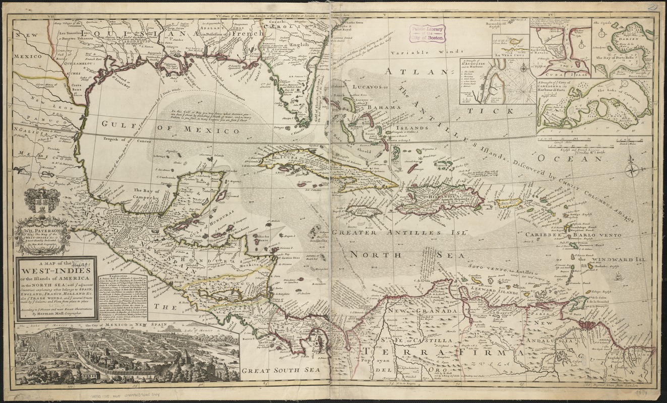
A map of the West-Indies or the islands of America in the North Sea : with ye adjacent countries; explaning [sic] what belongs to Spain, England, France, Holland &c. also ye trade winds, and ye several tracts made by ye galeons and flota from place to place ; according to ye newest and most exact observations
A map of the West-Indies or the islands of America in the North Sea
Item Information
Title:
A map of the West-Indies or the islands of America in the North Sea : with ye adjacent countries; explaning [sic] what belongs to Spain, England, France, Holland &c. also ye trade winds, and ye several tracts made by ye galeons and flota from place to place ; according to ye newest and most exact observations
Shows southern United States, Mexico, Central America, West Indies, and northern South America.
Relief shown pictorially.
Insets: The city of Mexico in New Spain -- A draught of ye citty of Cartagena, its harbour & forts -- The bay of Porto Bella -- A draught of the bay & citty of Havanna -- A draught of St. Augustin and its harbour -- La Vera Cruz.
Includes historical notes.
"Sold by H. Moll and by I. King at ye Globe in ye Poultrey near Stocks Market."
"To Wil. Paterson esq; this map of the West-Indies &c. is most humbly dedicated ..."
Cataloging, conservation, and digitization made possible in part by The National Endowment for the Humanities: Exploring the human endeavor.