Skip to search
Skip to main content
Digital Commonwealth
Sign Up / Log In
Search for
Search
Search
Search
Basic
Advanced
Explore
Map
Collections
Institutions
Formats
For Educators
Primary Source Sets
Lesson Plans
Using Primary Sources
Searching Digital Commonwealth
For Institutions
Join Digital Commonwealth
Conferences, Trainings, & Events
How to Contribute Collections
Digitization Services
Board & Committees
Frequently Asked Questions
About
About Digital Commonwealth
News & Announcements
Copyright & Terms of Use
Harmful Content Statement
Partners
API
Contact Us
Boston Public Library
Norman B. Leventhal Map Center Collection
/
Urban Maps (Collection of Distinction)
/
Boston and New England Maps (Collection of Distinction)
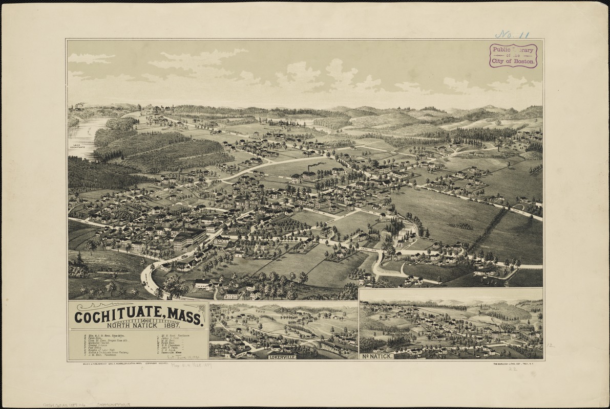
Cochituate, Mass. and North Natick, 1887
Cochituate, Mass. and North Natick, 1887
×
Item Information
Title:
Cochituate, Mass. and North Natick, 1887
Title (alt.):
Cochituate, Massachusetts and North Natick, 1887
Creator:
Norris, George E.
Name on Item:
drawn & published by Geo. E. Norris.
Date:
[1887]
Format:
Maps/Atlases
Location:
Boston Public Library
Norman B. Leventhal Map Center
Collection (local):
Norman B. Leventhal Map Center Collection
Subjects:
Cochituate (Mass.)--Aerial views
North Natick (Mass.)--Aerial views
Lokerville (Mass.)--Aerial views
Places:
Middlesex (county)
>
Cochituate
Middlesex (county)
>
Natick
>
North Natick
Middlesex (county)
>
Lokerville
Extent:
2 views on 1 sheet : col. ; 38 x 57 cm. and 9 x 22 cm., sheet 49 x 66 cm.
Permalink:
https://ark.digitalcommonwealth.org/ark:/50959/cj82m071n
Terms of Use:
No known copyright restrictions.
No known restrictions on use.
Publisher:
Brockton, Mass : Geo. E. Norris
Scale:
Not drawn to scale.
Language:
English
Notes:
Bird's-eye view.
Includes index to points of interest and inset view of Lokerville.
Notes (date):
This date is inferred.
Identifier:
06_01_002134
Call #:
G3764.C63A3 1887 .N6
Barcode:
39999058991918
LCCN:
2005628466
show more...
View MODS XML
More Like This
The 100th anniversary map of Abraham Lincoln's visit to ...
1630 shoreline
1879. Progress map of the U.S. Geographical Surveys west of the ...
1903 Map of Salem and surrounding places
Find More Like This >>
Tools
Share
Facebook
Pinterest
X
Reddit
Tumblr
Email
Copy link
Add to Folder
Questions/Comments
Cite This Item
IIIF Manifest
Downloads
Primary (full resolution, uncompressed)
(TIF, 136 MB)
Large (full resolution)
(JPEG, 11.4 MB)
Medium
(JPEG, 329 KB)