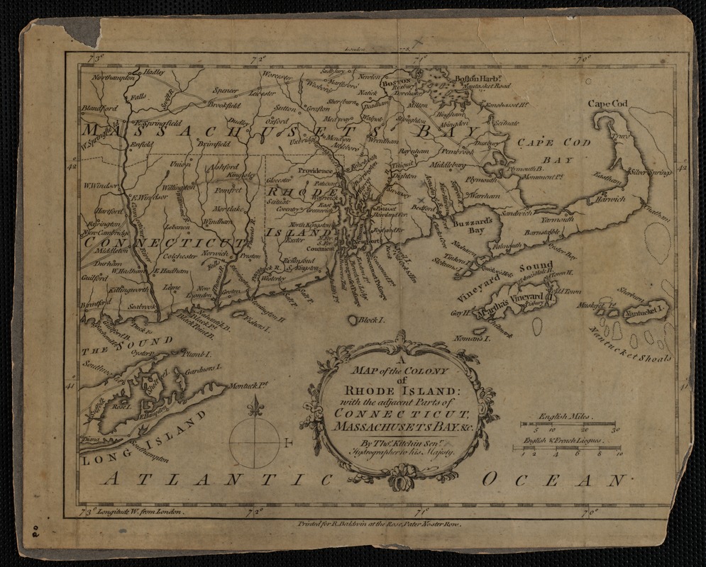
Map of the Colony of Rhode Island with the adjacent parts of Connecticut, Massachusetts Bay
Item Information
- Title:
- Map of the Colony of Rhode Island with the adjacent parts of Connecticut, Massachusetts Bay
- Description:
-
Black and white photo of colonial era map (1778) of Massachusetts, Rhode Island and Connecticut; map produced by Thomas Kitchin, Sr.; printed for R. Baldwin. Mounted to dark gray cardboard with label describing donation glued to back
- Date:
-
[ca. 1860–1955]
- Format:
-
Photographs
- Genre:
-
Photographic prints
- Location:
-
New Bedford Free Public Library
Main Library, room 309, cabinet U07, shelf SH10, container BX14:F040 (shelf locator) - Collection (local):
-
Photograph Collection
- Places:
-
New England (area)
- Extent:
- 1 photograph : print
- Permalink:
- https://ark.digitalcommonwealth.org/ark:/50959/cn69mr57b
- Terms of Use:
-
Rights status not evaluated.
This work is licensed for use under a Creative Commons Attribution Non-Commercial No Derivatives License (CC BY-NC-ND).