Skip to search
Skip to main content
Digital Commonwealth
Sign Up / Log In
Search for
Search
Search
Search
Basic
Advanced
Explore
Map
Collections
Institutions
Formats
For Educators
Primary Source Sets
Lesson Plans
Using Primary Sources
Searching Digital Commonwealth
For Institutions
Join Digital Commonwealth
Conferences, Trainings, & Events
How to Contribute Collections
Digitization Services
Board & Committees
Frequently Asked Questions
About
About Digital Commonwealth
News & Announcements
Copyright & Terms of Use
Harmful Content Statement
Partners
API
Contact Us
Boston Public Library
Norman B. Leventhal Map Center Collection
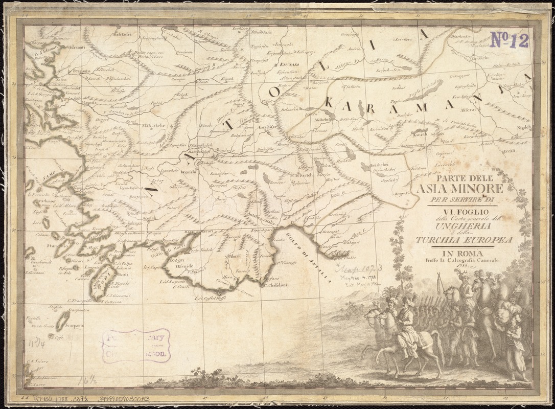
Parte dell'Asia Minore per servire di VI foglio della carta generale dell'Ungheria e della Turchia Europea
Parte dellAsia Minore per servire di VI foglio della carta generale dellUngheria e della Turchia Europea
×
Item Information
Title:
Parte dell'Asia Minore per servire di VI foglio della carta generale dell'Ungheria e della Turchia Europea
Creator:
Cassini, Gio. Ma. (Giovanni Maria), 1745-ca. 1824
Date:
[1792]
Format:
Maps/Atlases
Location:
Boston Public Library
Norman B. Leventhal Map Center
Collection (local):
Norman B. Leventhal Map Center Collection
Subjects:
Turkey--Maps--Early works to 1800
Places:
Turkey
Extent:
1 map : col. ; 30 x 42 cm.
Permalink:
https://ark.digitalcommonwealth.org/ark:/50959/kk91fq45r
Terms of Use:
No known copyright restrictions.
No known restrictions on use.
Publisher:
Roma : Presso la Calcografia Camerale
Scale:
Scale not given.
Language:
Italian
Notes:
Relief shown pictorially.
In upper right margin: "Tom. I. no. 55."
Map dated 1788.
Appears in the author's Nuovo atlante geographico universale delineato sulle ultime osservazioni. Rome: Calcografia Camerale, 1792. Vol. 1, no. 55.
Notes (date):
This date is inferred.
Identifier:
06_01_007152
Call #:
G7430 1788 .C37x
Barcode:
39999059030013
show more...
View MODS XML
More Like This
Accuratissima et maxima totius Turcici Imperii tabula cum omnibus ...
Asiæ quæ vulgo minor dicitur et Syriæ tabula geographica : quantum ...
Greece, Archipelago and part of Anadoli
Greece with part of Anatolia = La Graecia con parte della Natolia
Find More Like This >>
Tools
Share
Facebook
Pinterest
X
Reddit
Tumblr
Email
Copy link
Add to Folder
Questions/Comments
Cite This Item
IIIF Manifest
Downloads
Primary (full resolution, uncompressed)
(TIF, 184 MB)
Large (full resolution)
(JPEG, 15.5 MB)
Medium
(JPEG, 344 KB)