Skip to search
Skip to main content
Digital Commonwealth
Sign Up / Log In
Search for
Search
Search
Search
Basic
Advanced
Explore
Map
Collections
Institutions
Formats
For Educators
Primary Source Sets
Lesson Plans
Using Primary Sources
Searching Digital Commonwealth
For Institutions
Join Digital Commonwealth
Conferences, Trainings, & Events
How to Contribute Collections
Digitization Services
Board & Committees
Frequently Asked Questions
About
About Digital Commonwealth
News & Announcements
Copyright & Terms of Use
Harmful Content Statement
Partners
API
Contact Us
Boston Public Library
Norman B. Leventhal Map Center Collection
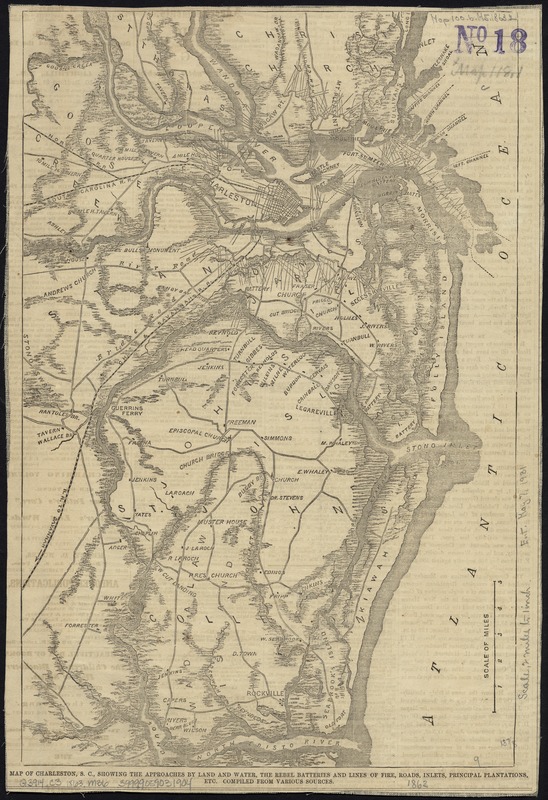
Map of Charleston, S.C., showing the approaches by land and water, the rebel batteries and lines of fire, roads, inlets, principal plantations, etc
Map of Charleston, S.C., showing the approaches by land and water, the rebel batteries and lines of fire, roads, inlets, principal plantations, etc
×
Item Information
Title:
Map of Charleston, S.C., showing the approaches by land and water, the rebel batteries and lines of fire, roads, inlets, principal plantations, etc
Name on Item:
compiled from various sources.
Date:
[1863]
Format:
Maps/Atlases
Location:
Boston Public Library
Norman B. Leventhal Map Center
Collection (local):
Norman B. Leventhal Map Center Collection
Subjects:
Charleston Region (S.C.)--History--19th century--Maps
Charleston Harbor (S.C.)--Maps
Places:
Charleston (county)
>
Charleston Harbor
(bay)
Charleston (county)
>
Charleston
Extent:
1 map : col. ; 36 x 24 cm.
Permalink:
https://ark.digitalcommonwealth.org/ark:/50959/kk91ft108
Terms of Use:
No known copyright restrictions.
No known restrictions on use.
Publisher:
New York : Harper's Magazine Co.
Scale:
Scale [ca. 1:126,720]
Language:
English
Notes:
Detached from: Harper's weekly (Mar. 28, 1863).
Notes (date):
This date is inferred.
Identifier:
06_01_007491
Call #:
G3914.C3 1863 .M36
Barcode:
39999059031904
show more...
View MODS XML
More Like This
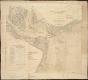
Charleston Harbor and its approaches showing the positions of the ...
General map of Charleston Harbor South Carolina showing rebel ...
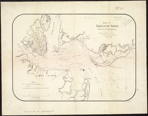
Plan of Charleston Harbor, and its fortifications
The 100th anniversary map of Abraham Lincoln's visit to ...
Find More Like This >>
Tools
Share
Facebook
Pinterest
X
Reddit
Tumblr
Email
Copy link
Add to Folder
Questions/Comments
Cite This Item
IIIF Manifest
Downloads
Primary (full resolution, uncompressed)
(TIF, 152 MB)
Large (full resolution)
(JPEG, 12.8 MB)
Medium
(JPEG, 209 KB)