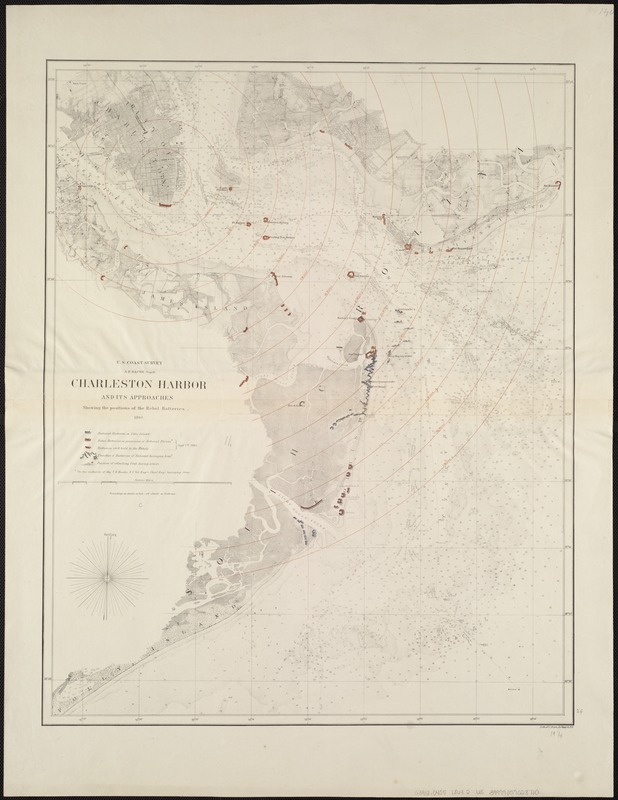
Shows roads, railroads, houses, vegetation, a street plan of Charleston, drainage, and shoals.
Depths shown by soundings.
Overprinted to show 1/2-mile concentric circles centered on St. Michaels, Charleston extending as far as 7 miles.
Includes index for batters, trenches, and fleet positions.