Skip to search
Skip to main content
Digital Commonwealth
Sign Up / Log In
Search for
Search
Search
Search
Basic
Advanced
Explore
Map
Collections
Institutions
Formats
For Educators
Primary Source Sets
Lesson Plans
Using Primary Sources
Searching Digital Commonwealth
For Institutions
Join Digital Commonwealth
Conferences, Trainings, & Events
How to Contribute Collections
Digitization Services
Board & Committees
Frequently Asked Questions
About
About Digital Commonwealth
News & Announcements
Copyright & Terms of Use
Harmful Content Statement
Partners
API
Contact Us
Boston Public Library
Norman B. Leventhal Map Center Collection
/
Urban Maps (Collection of Distinction)
/
Boston and New England Maps (Collection of Distinction)
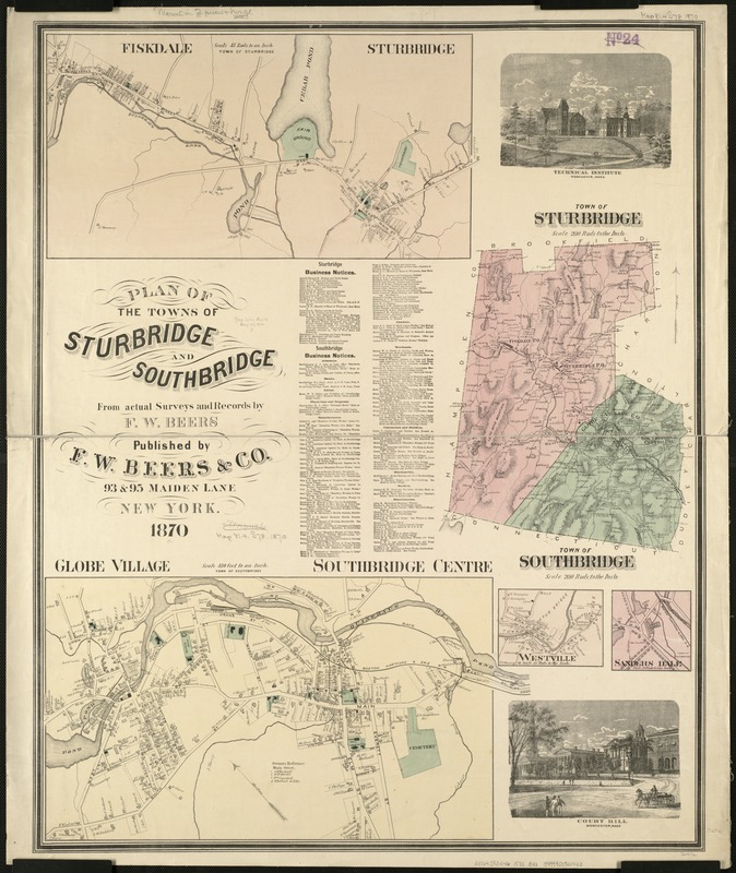
Plan of the towns of Sturbridge and Southbridge : from actual surveys and records
Plan of the towns of Sturbridge and Southbridge
×
Item Information
Title:
Plan of the towns of Sturbridge and Southbridge : from actual surveys and records
Creator:
Beers, F. W. (Frederick W.)
Name on Item:
by F.W. Beers.
Date:
1870
Format:
Maps/Atlases
Location:
Boston Public Library
Norman B. Leventhal Map Center
Collection (local):
Norman B. Leventhal Map Center Collection
Subjects:
Real property--Massachusetts--Sturbridge--Maps
Landowners--Massachusetts--Sturbridge--Maps
Real property--Massachusetts--Southbridge--Maps
Landowners--Massachusetts--Southbridge--Maps
Sturbridge (Mass. : Town)--Maps
Southbridge (Mass.)--Maps
Places:
Worcester (county)
>
Southbridge
Worcester (county)
>
Sturbridge
Extent:
1 map : col. ; 79 x 63 cm.
Permalink:
https://ark.digitalcommonwealth.org/ark:/50959/x059cb92c
Terms of Use:
No known copyright restrictions.
No known restrictions on use.
Publisher:
New York : F.W. Beers
Scale:
Scale 1:39,600.
Language:
English
Notes:
Includes list of business notices.
Insets: Globe Village and Southbridge Centre, Westville, Sanders Dale, Fiskdale and Sturbridge, and two ill.
Identifier:
06_01_005464
Call #:
G3764.S83G46 1870 .B4x
Barcode:
39999059014413
show more...
View MODS XML
More Like This
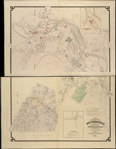
Map of the town of Southbridge, Mass : including detail plans of ...
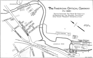
American Optical Company in 1921 campus map: dates indicate the ...
Atlas of the boundaries of the cities of Chicopee and Springfield ...
The 100th anniversary map of Abraham Lincoln's visit to ...
Find More Like This >>
Tools
Share
Facebook
Pinterest
X
Reddit
Tumblr
Email
Copy link
Add to Folder
Questions/Comments
Cite This Item
IIIF Manifest
Downloads
Primary (full resolution, uncompressed)
(TIF, 186 MB)
Large (full resolution)
(JPEG, 15.6 MB)
Medium
(JPEG, 216 KB)