Skip to search
Skip to main content
Digital Commonwealth
Sign Up / Log In
Search for
Search
Search
Search
Basic
Advanced
Explore
Map
Collections
Institutions
Formats
For Educators
Primary Source Sets
Lesson Plans
Using Primary Sources
Searching Digital Commonwealth
For Institutions
Join Digital Commonwealth
Conferences, Trainings, & Events
How to Contribute Collections
Digitization Services
Board & Committees
Frequently Asked Questions
About
About Digital Commonwealth
News & Announcements
Copyright & Terms of Use
Harmful Content Statement
Partners
API
Contact Us
Boston Public Library
Norman B. Leventhal Map Center Collection
/
Urban Maps (Collection of Distinction)
/
Boston and New England Maps (Collection of Distinction)
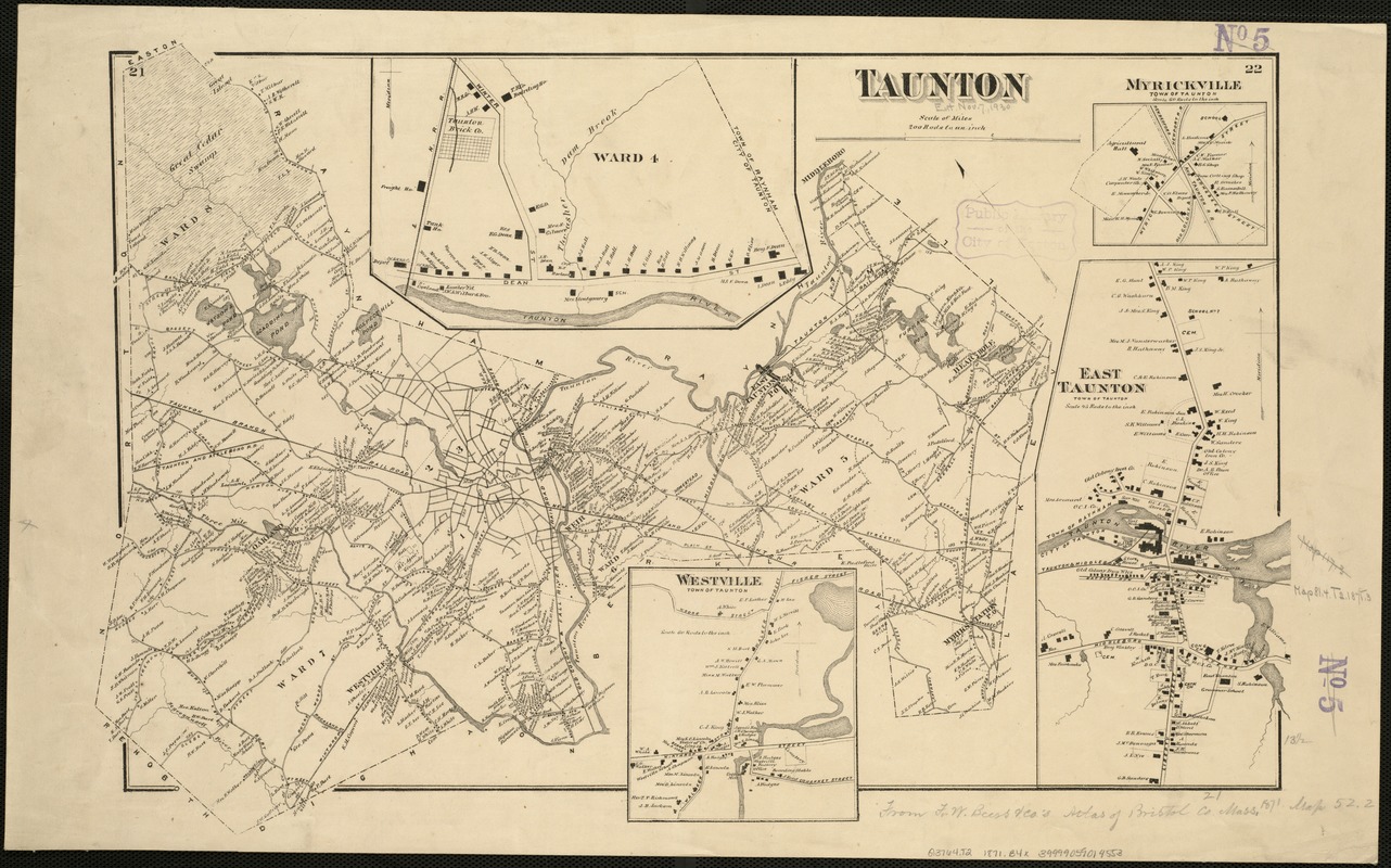
Taunton
Taunton
×
Item Information
Title:
Taunton
Creator:
Beers, F. W. (Frederick W.)
Date:
[1871]
Format:
Maps/Atlases
Location:
Boston Public Library
Norman B. Leventhal Map Center
Collection (local):
Norman B. Leventhal Map Center Collection
Subjects:
Taunton (Mass.)--Maps
Places:
Bristol (county)
>
Taunton
Extent:
1 map ; 37 x 56 cm.
Permalink:
https://ark.digitalcommonwealth.org/ark:/50959/x059cc082
Terms of Use:
No known copyright restrictions.
No known restrictions on use.
Publisher:
New York : F.W. Beers & Co.
Scale:
Scale 1:39,600.
Language:
English
Notes:
Insets: Myrickville, East Taunton, Westville, and Ward 4.
Appears in F.W. Beers "Atlas of Bristol Co. Massachusetts", 1871.
Notes (date):
This date is inferred.
Identifier:
06_01_005471
Call #:
G3764.T2 1871 .B4x
Barcode:
39999059014553
show more...
View MODS XML
More Like This
Atlas of Taunton City, Massachusetts
City of Taunton
Map of Bristol County Massachusetts : based on the trigonometrical ...
Map of Taunton
Find More Like This >>
Tools
Share
Facebook
Pinterest
X
Reddit
Tumblr
Email
Copy link
Add to Folder
Questions/Comments
Cite This Item
IIIF Manifest
Downloads
Primary (full resolution, uncompressed)
(TIF, 36.1 MB)
Large (full resolution)
(JPEG, 3.03 MB)
Medium
(JPEG, 373 KB)