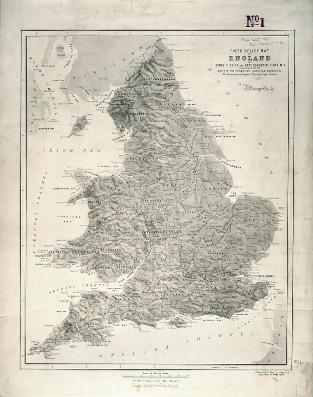
England's physical geography, especially its topography and rivers, is portrayed on this late 19th century map published by the Society for Promoting Christian Knowledge, a British missionary and charitable organization. The Society was founded in 1698 and has been continuously active for over 300 years. In addition to their missionary and liturgical publications, the Society also published maps and atlases for the general education of its members. One such map is this physical relief map, which also displays the names of towns and counties, but does not delineate county boundaries.