Skip to search
Skip to main content
Digital Commonwealth
Sign Up / Log In
Search for
Search
Search
Search
Basic
Advanced
Explore
Map
Collections
Institutions
Formats
For Educators
Primary Source Sets
Lesson Plans
Using Primary Sources
Searching Digital Commonwealth
For Institutions
Join Digital Commonwealth
Conferences, Trainings, & Events
How to Contribute Collections
Digitization Services
Board & Committees
Frequently Asked Questions
About
About Digital Commonwealth
News & Announcements
Copyright & Terms of Use
Harmful Content Statement
Partners
API
Contact Us
Boston Public Library
Norman B. Leventhal Map Center Collection
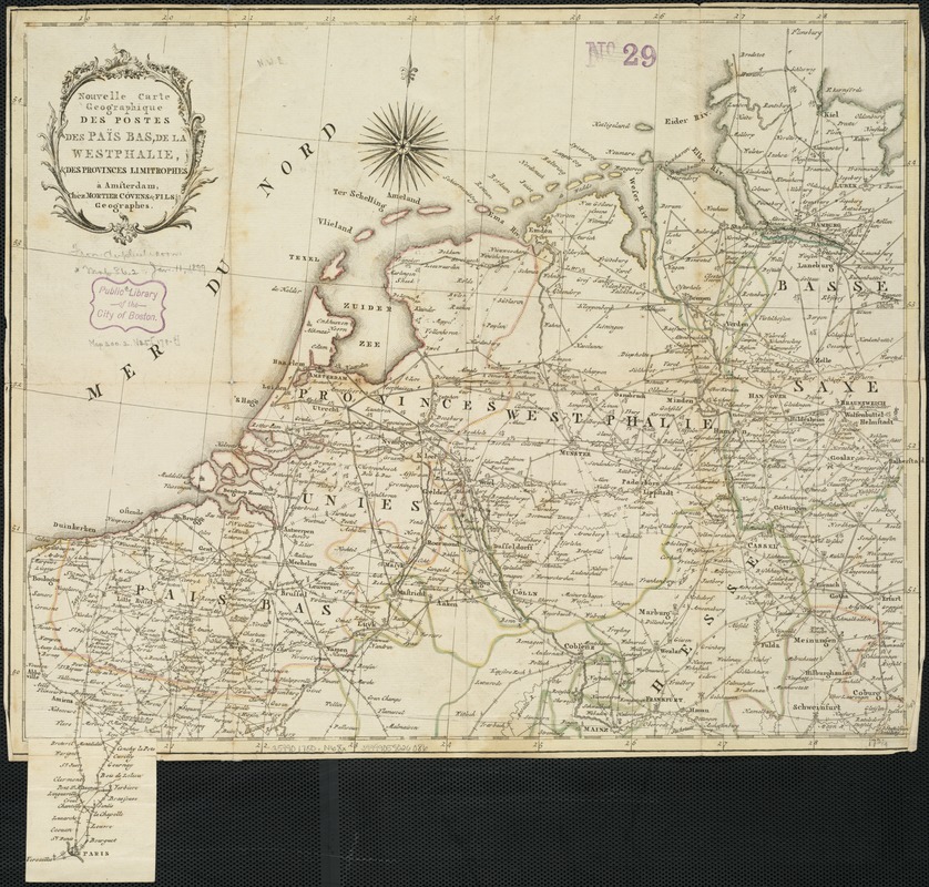
Nouvelle carte geographique des postes des Païs Bas, de la Westphalie, & des provinces limitrophes
Nouvelle carte geographique des postes des Païs Bas, de la Westphalie, & des provinces limitrophes
×
Item Information
Title:
Nouvelle carte geographique des postes des Païs Bas, de la Westphalie, & des provinces limitrophes
Title (alt.):
Routes des postes des Pays Bas de la Westohalie et des provinces limitrophes
Date:
[1780?]
Format:
Maps/Atlases
Location:
Boston Public Library
Norman B. Leventhal Map Center
Collection (local):
Norman B. Leventhal Map Center Collection
Subjects:
Benelux countries--Maps--Early works to 1800
Westphalia (Germany)--Maps--Early works to 1800
Places:
Germany
>
North Rhine-Westphalia
>
Westphalia
(area)
Low Countries
(area)
Extent:
1 map : outline col. ; 37 x 45 cm.
Permalink:
https://ark.digitalcommonwealth.org/ark:/50959/xg94j163m
Terms of Use:
No known copyright restrictions.
No known restrictions on use.
Publisher:
A Amsterdam : Chéz Mortier Cóvens & Fils
Scale:
Scale not given
Language:
French
Notes:
Includes continuation of map on slip from Amiens to Paris.
Inside cover: Explication des marques et figures.
Identifier:
06_01_006493
Call #:
G5990 1780 .N68x
Barcode:
39999059026086
show more...
View MODS XML
More Like This
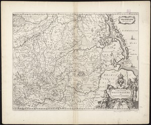
Circulus Westphalicus, sive Germaniae inferioris
Belgii veteris typus
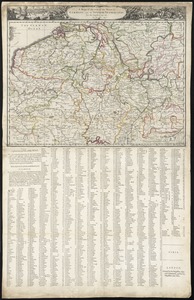
A mapp of the seat of the warrs in Germany and the Spanish ...
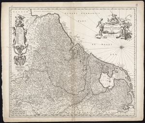
Novissima et accuratissima XVII provinciarum Germaniae inferioris ...
Find More Like This >>
Tools
Share
Facebook
Pinterest
X
Reddit
Tumblr
Email
Copy link
Add to Folder
Questions/Comments
Cite This Item
IIIF Manifest
Downloads
Primary (full resolution, uncompressed)
(TIF, 148 MB)
Large (full resolution)
(JPEG, 12.4 MB)
Medium
(JPEG, 301 KB)