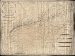
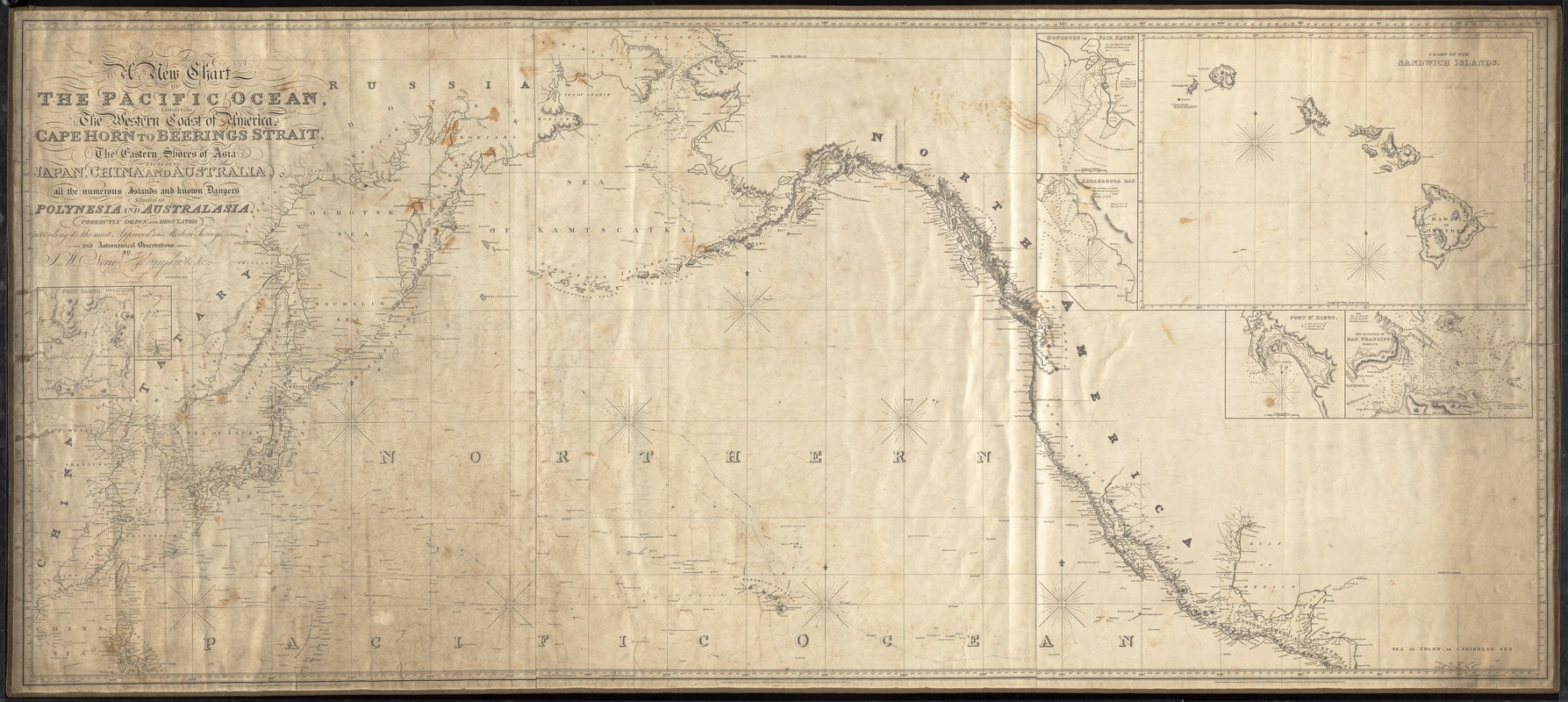
A new chart of the Pacific Ocean : Exhibiting the western coast of America, from Cape Horn to Beerings Straight, the eastern shores of Asia, including Japan, China, and Australia, and all the numerous islands and known dangers situated in Polynesia and Australasia. Additions 1836
Item Information
- Title:
- A new chart of the Pacific Ocean : Exhibiting the western coast of America, from Cape Horn to Beerings Straight, the eastern shores of Asia, including Japan, China, and Australia, and all the numerous islands and known dangers situated in Polynesia and Australasia. Additions 1836
- Description:
-
Shows courses of unknown ships in pencil. Some printed courses, such as Captain Cook's voyage near the Sandwich Islands, 1778. Some illegible notations.
- Creator:
- Norie, J. W. (John William), 1772-1843
- Engraver:
- Stephenson, John (Engraver), active 1791-1817
- Name on Item:
-
Correctly drawn and registered according to the most approved and modern surveys and astonomical observations by J.W. Norie, hydrographer, &c. &c. ; Stephenson, engraver
- Date:
-
1825
- Format:
-
Maps/Atlases
- Location:
-
New Bedford Whaling Museum
Research Library - Collection (local):
-
New Bedford Whaling Museum Research Library Cartography Collection
- Places:
-
Pacific Ocean
- Extent:
- 1 map ; on sheet 82 x 183 cm
- Permalink:
- https://ark.digitalcommonwealth.org/ark:/50959/zk51wb22c
- Terms of Use:
-
No known copyright restrictions. Contact host institution for more information.
This work is licensed for use under a Creative Commons Attribution Non-Commercial License (CC BY-NC).