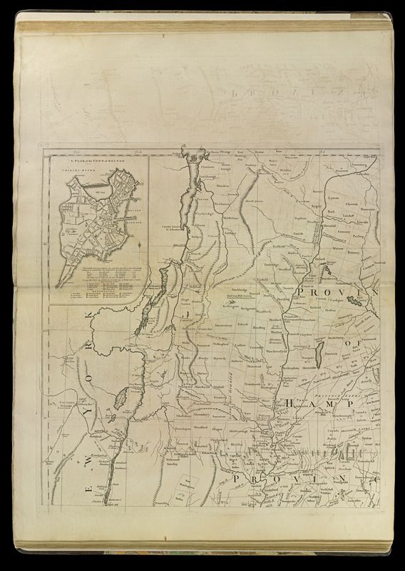
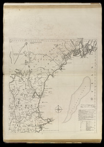
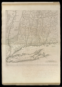
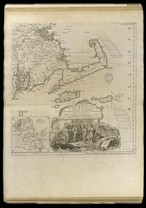
A map of the most inhabited part of New England : containing the provinces of Massachusets Bay and New Hampshire, with the colonies of Conecticut and Rhode Island, divided into counties and townships : the whole composed from actual surveys and its situation adjusted by astronomical observations
A map of the most inhabited part of New England : containing the provinces of Massachusets Bay and New Hampshire, with the colonies of Conecticut and Rhode Island, divided into counties and townships : the whole composed from actual surveys and its situation adjusted by astronomical observations
2nd edition, 1st issue (Stevens & Tree).
2nd state (LC).
Prime meridians: London and Ferro.
Relief shown pictorially.
Insets: A plan of the town of Boston -- A plan of Boston Harbor from an accurate survey [ca. 1:150,000].
Imprint November 29th 1755 but published ca. 1763.
Notes (citation):
Stevens & Tree. Comparative cartography, 33c
LC Maps of North America, 1750-1789, 798
McCorkle, B. New England in early printed maps, 755.19