An actual survey of the sea coast from New York to the I. Cape Brition : with tables of the direct and thwart courses & distances from place to place
Item Information
- Title:
- An actual survey of the sea coast from New York to the I. Cape Brition : with tables of the direct and thwart courses & distances from place to place
- Description:
-
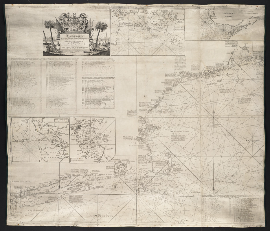
Southack, who lived in Boston after 1685, is recognized as America's first chartmaker. His extensive experience as a navigator and privateer in America's waters enabled him to produce several charts of the New England coast. This one provided detailed navigational aids for the northeast coast from Long Island to Cape Breton Island. Besides an inset of Boston Harbor, it also included insets of New York Harbor, Casco Bay, and Halifax Harbor. Another version of this chart appeared in various editions of The English Pilot, The Fourth Book, the standard 18th century guide to English navigation.
- Creator:
- Southack, Cyprian, 1662-1745
- Name on Item:
-
by Capt. Cyprian, Southack ; illustrated, with particular plans, of the harbours of New York, Boston, Canso Bay & Annopolis Royal, on a larger scale
- Date:
-
[1735]
- Format:
-
Maps/Atlases
- Location:
- Private Collection
- Collection (local):
-
Mapping Boston Collection
- Subjects:
-
Nautical charts--Atlantic Coast (North America)--Early works to 1800
Atlantic Coast (North America)--Maps--Early works to 1800
New England--Maps--Early works to 1800
- Places:
-
New England (area)
- Extent:
- 1 map ; 107 x 126 cm.
- Permalink:
- https://ark.digitalcommonwealth.org/ark:/50959/3f462t65c
- Terms of Use:
-
No known copyright restrictions.
This work is licensed for use under a Creative Commons Attribution Non-Commercial Share Alike License (CC BY-NC-SA).


