A chart of the harbour of Boston
Item Information
- Title:
- A chart of the harbour of Boston
- Description:
-
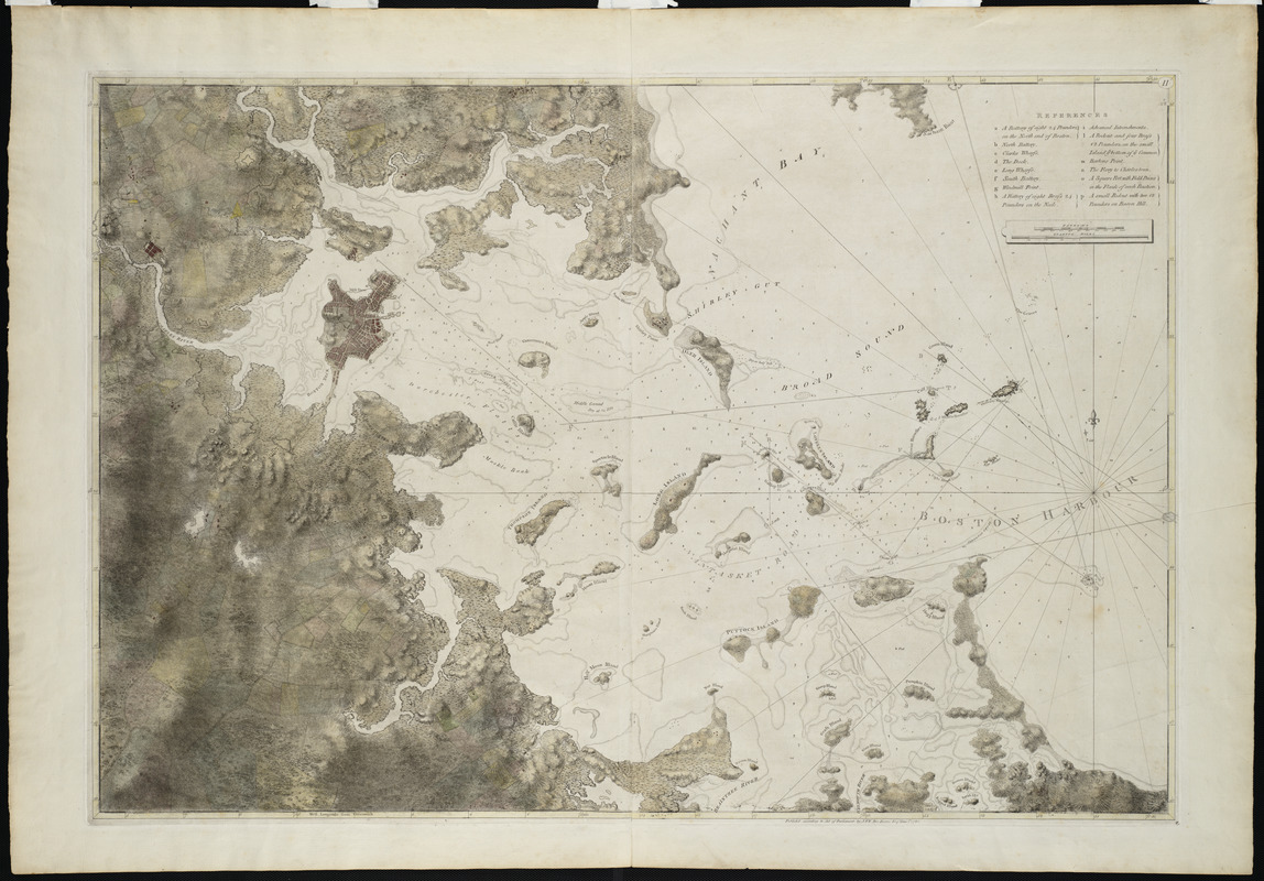
This survey of Boston Harbor, first published in 1775 in Des Barres's Atlantic Neptune, was the pre-eminent chart of the harbor produced in the 18th century. It was used by the Royal Navy during the American Revolution, and long after that conflict by American and English merchants. The chart was based on surveys by George Callendar, master of His Majesty's Ship Romney, stationed in Boston Harbor in 1769. Displayed here is the fourth state of the chart which depicts the inland topography in great detail. Roads, taverns, streams and farmhouses are shown throughout the countryside.
- Creator:
- Des Barres, Joseph F. W. (Joseph Frederick Wallet), 1722-1824
- Date:
-
1781
- Format:
-
Maps/Atlases
- Location:
- Private Collection
- Collection (local):
-
Mapping Boston Collection
- Subjects:
-
Nautical charts--Massachusetts--Boston Bay--Early works to 1800
Nautical charts--Massachusetts--Boston Harbor--Early works to 1800
Boston Bay (Mass.)--Maps--Early works to 1800
Boston Harbor (Mass.)--Maps--Early works to 1800
- Places:
-
Boston Harbor
- Extent:
- 1 map : hand col. ; 82 x 122 cm.
- Permalink:
- https://ark.digitalcommonwealth.org/ark:/50959/3f462x472
- Terms of Use:
-
No known copyright restrictions.
This work is licensed for use under a Creative Commons Attribution Non-Commercial Share Alike License (CC BY-NC-SA).


