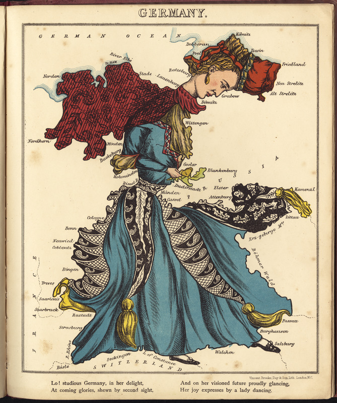
Back to School: The unique atlas referenced here contains twelve maps of European countries, each being portrayed as a stereotypical caricature of the location. Similarly to the creators of the Eagle Map, the atlas’ author, William Harvey, believed that visualizing geography in such a way would make the subject easier to understand, and more educational. Thus, he drew the major European countries as human figures reflecting national stereotypes, such as England in the form of Queen Victoria, and Scotland as a bagpipe player dressed in a kilt. Germany portrayed as a lady dancing is reproduced here.
Pictorial map depicting Germany as a lady dancing.
Rhyme about the country in lower margin.
In Lancaster and Harvey's Geographical fun. London : Hodder and Stoughton, [1868 or 1869].
Notes (exhibitions):
Exhibited: "Back to School: Geography in the Classroom" organized by the Norman B. Leventhal Map Center at the Boston Public Library, 2014-2015.