Topographical map of the City and County of New-York, and the adjacent country : with views in the border of the principal buildings, and interesting scenery of the island
Topographical map of the City and County of New-York, and the adjacent country
Item Information
Title:
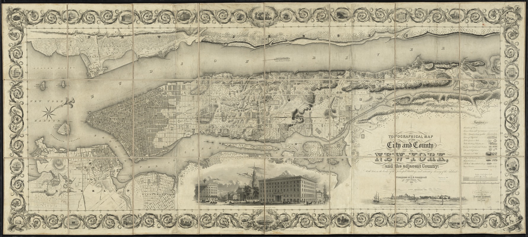
Topographical map of the City and County of New-York, and the adjacent country : with views in the border of the principal buildings, and interesting scenery of the island
Oriented with north towards the upper right.
Relief shown by hachures.
Shows wards, physical features, public buildings, and various places of interest.
First state, without Madison Square.
Illustrations: Broadway from the park -- Nieuw Amsterdam, 1659.
Includes ornamental border with vignettes.
"Entered according to act of Congress in the year 1836 by J.H. Colton & Co. in the Clerks Office of the District Court of the Southern District of New York."