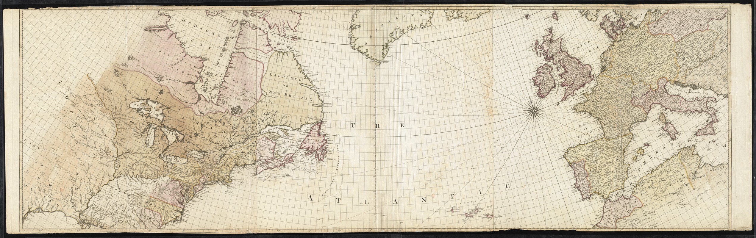
A chart of the Atlantic Ocean : its islands and the adjacent continents: In which the British Dominions in Europe and America, the West Indies, and on the African coast are seen at one view: The distances and superficial dimensions retaining every where very nearly their just proportions, and the rumbs, exactly delineated, shew the nautical courses from any port to the entrance of the British Channel, or between any two ports proposed
A chart of the Atlantic Ocean : its islands and the adjacent continents: In which the British Dominions in Europe and America, the West Indies, and on the African coast are seen at one view: The distances and superficial dimensions retaining every where very nearly their just proportions, and the rumbs, exactly delineated, shew the nautical courses from any port to the entrance of the British Channel, or between any two ports proposed
Collection of the Boston Athenaeum. May not be reproduced or quoted without written permission. For more information, see http://www.bostonathenaeum.org/node/46
Contact host institution for more information.
North and South sheets.
Relief shown pictorially.
"Projected in the manner which is described and recommended by the Revd. Pr. Murdoch, F.R.S. in vol. 1, part 2d, no. 73. of the Philosophical transactions."
Includes "Note."
Issued as maps 1-2 of: The North American Atlas / William Faden. London : W. Faden, 1777.