Map of Watertown
Item Information
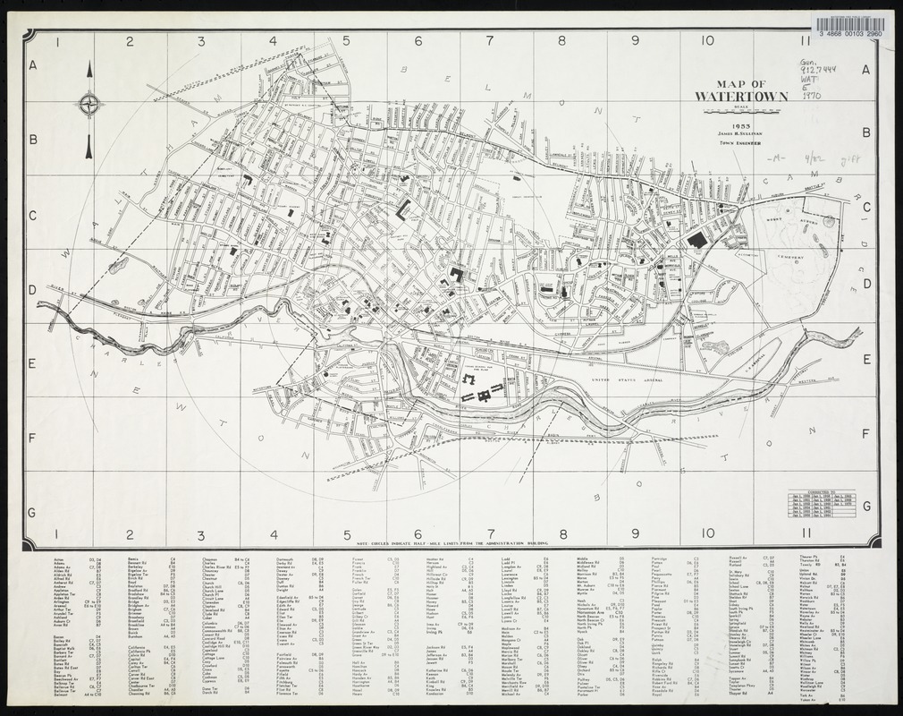
- Title:
- Map of Watertown
- Description:
-
At bottom of map: "Circles indicate half-mile limits from the Administration Building."
- Engineer:
- Sullivan, James H.
- Name on Item:
-
James H. Sullivan, Town Engineer.
- Date:
-
1970
- Format:
-
Maps/Atlases
- Location:
- Watertown Free Public Library
- Collection (local):
-
Watertown Free Public Library Local History Collection
- Subjects:
-
Watertown (Mass.). Town Engineer.
- Places:
-
MassachusettsMiddlesex (county)Watertown
- Extent:
- 1 map ; 63 x 38 cm.
- Permalink:
- https://ark.digitalcommonwealth.org/ark:/50959/5m60r465g
- Terms of Use:
-
Rights status not evaluated.
This work is licensed for use under a Creative Commons Attribution Non-Commercial No Derivatives License (CC BY-NC-ND).