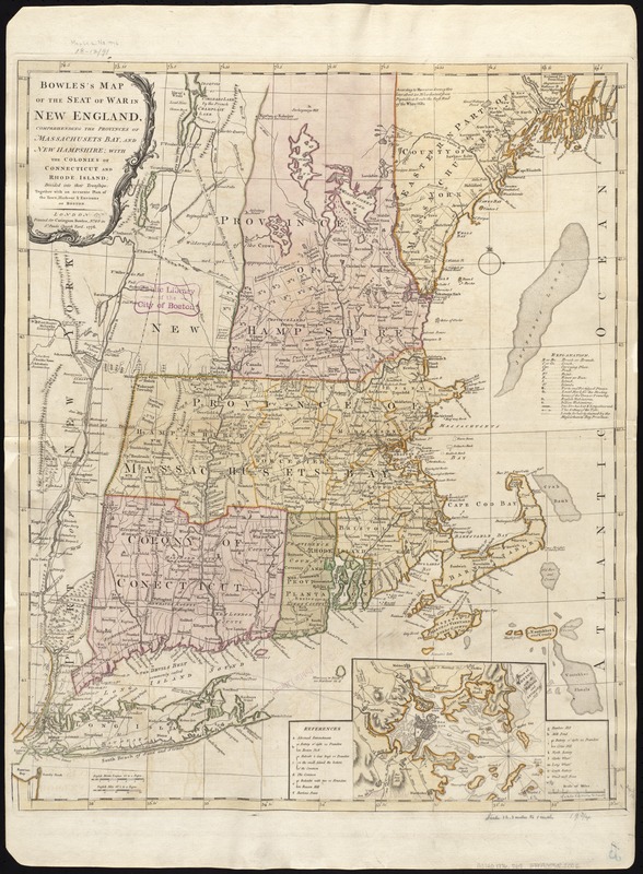
Bowles's map of the seat of war in New England, comprehending the provinces of Massachusets Bay, and New Hampshire : with the colonies of Connecticut and Rhode Island ; divided into counties and townships ; together with an accurate plan of the town, harbour & environs of Boston
Bowless map of the seat of war in New England, comprehending the provinces of Massachusets Bay, and New Hampshire
Item Information
Title:
Bowles's map of the seat of war in New England, comprehending the provinces of Massachusets Bay, and New Hampshire : with the colonies of Connecticut and Rhode Island ; divided into counties and townships ; together with an accurate plan of the town, harbour & environs of Boston
Relief shown pictorially.
State 3 of Jeffery's Map of the most inhabited part of New England.
Untitled inset shows Boston and its harbor and includes a table of references.