An accurate map of North and South Carolina with their Indian frontiers, shewing in a distinct manner all the mountains, rivers, swamps, marshes, bays, creeks, harbours, sandbanks and soundings on the coasts : with the roads and Indian paths : as well as the boundary of provincial lines, the several townships and other divisions of the land in both the provinces
An accurate map of North and South Carolina with their Indian frontiers, shewing in a distinct manner all the mountains, rivers, swamps, marshes, bays, creeks, harbours, sandbanks and soundings on the coasts
Item Information
Title:
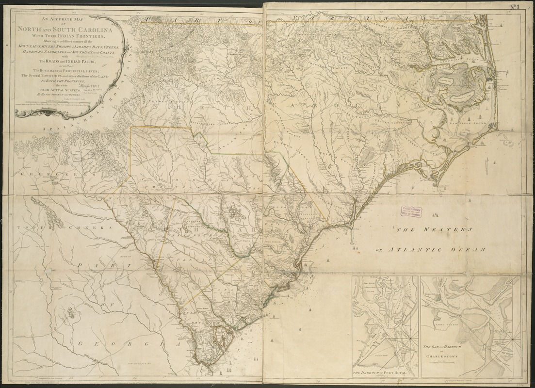
An accurate map of North and South Carolina with their Indian frontiers, shewing in a distinct manner all the mountains, rivers, swamps, marshes, bays, creeks, harbours, sandbanks and soundings on the coasts : with the roads and Indian paths : as well as the boundary of provincial lines, the several townships and other divisions of the land in both the provinces
Relief shown by hachures. Depths shown by soundings.
"Longitude west from London."
Shows precinct boundaries.
Insets: The harbour of Port Royal [ca. 1:200,000]--The bar and harbour of Charlestown [ca. 1:75,000].