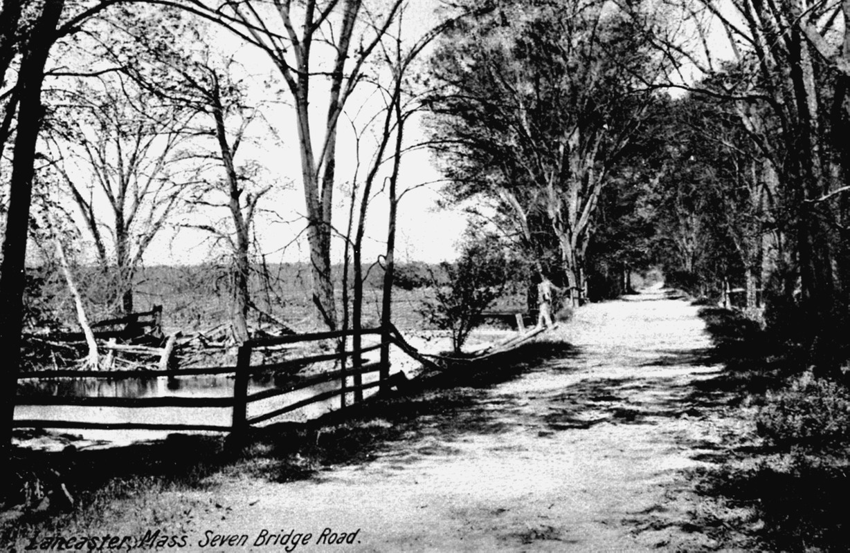
Seven Bridge Road
Item Information
- Title:
- Seven Bridge Road
- Description:
-
This road, which actually has seven bridges, was built sometime after 1800 as a toll road or turnpike. It was not accepted as a town road until years later. The view of what is present day Route 117 shows some very low land on the Nashua floodplain.
- Date:
-
[ca. 1850–2000]
- Format:
-
Photographs
- Location:
- Lancaster Historical Society
- Collection (local):
-
Photo Archives of the Lancaster (MA) Historical Society
- Subjects:
-
Rivers
Roads
- Places:
-
MassachusettsNashua River
MassachusettsWorcester (county)Lancaster
- Extent:
- 1 photograph
- Permalink:
- https://ark.digitalcommonwealth.org/ark:/50959/73666j45k
- Terms of Use:
-
Rights status not evaluated. You may contact host institution for more information.
This work is licensed for use under a Creative Commons Attribution Non-Commercial No Derivatives License (CC BY-NC-ND).