Skip to search
Skip to main content
Digital Commonwealth
Sign Up / Log In
Search for
Search
Search
Search
Basic
Advanced
Explore
Map
Collections
Institutions
Formats
For Educators
Primary Source Sets
Lesson Plans
Using Primary Sources
Searching Digital Commonwealth
For Institutions
Join Digital Commonwealth
Conferences, Trainings, & Events
How to Contribute Collections
Digitization Services
Board & Committees
Frequently Asked Questions
About
About Digital Commonwealth
News & Announcements
Copyright & Terms of Use
Harmful Content Statement
Partners
API
Contact Us
Boston Public Library
Norman B. Leventhal Map Center Collection
/
Boston and New England Maps (Collection of Distinction)
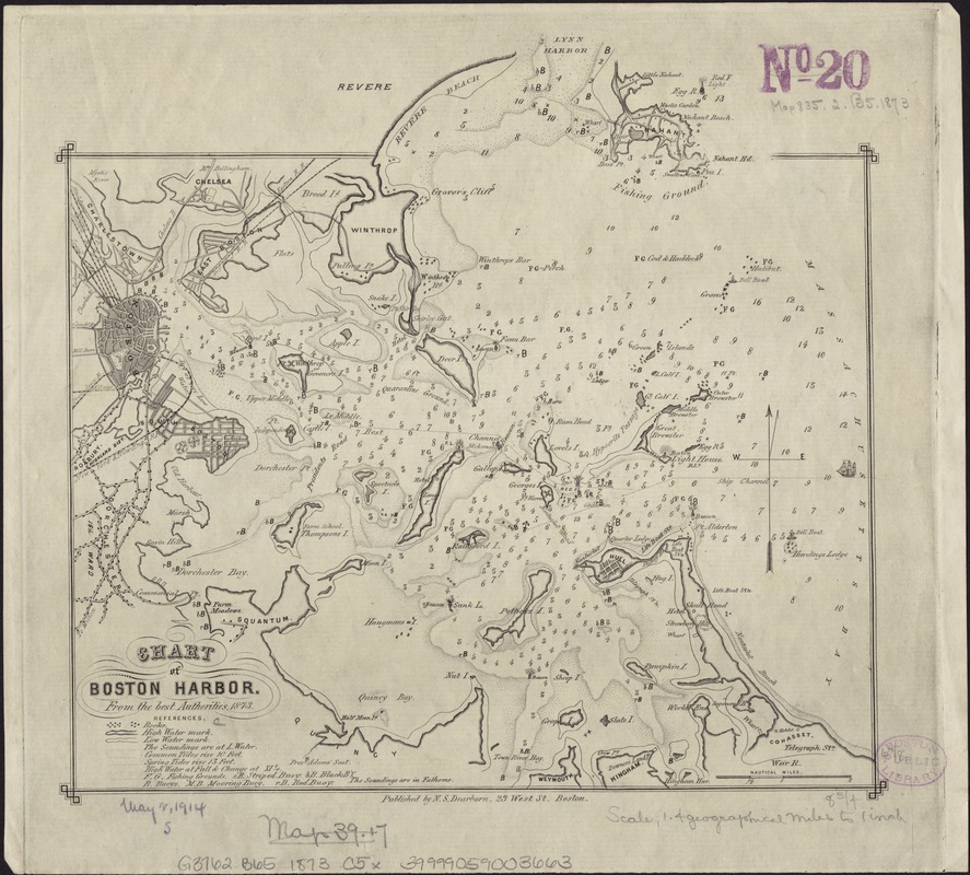
Chart of Boston Harbor : from the best authorities, 1873
Chart of Boston Harbor
×
Item Information
Title:
Chart of Boston Harbor : from the best authorities, 1873
Date:
[1873]
Format:
Maps/Atlases
Location:
Boston Public Library
Norman B. Leventhal Map Center
Collection (local):
Norman B. Leventhal Map Center Collection
Subjects:
Boston Harbor (Mass.)--Maps
Places:
Boston Harbor
Extent:
1 chart ; 21 x 22 cm.
Permalink:
https://ark.digitalcommonwealth.org/ark:/50959/9s161g16s
Terms of Use:
No known copyright restrictions.
No known restrictions on use.
Publisher:
Boston [Mass.] : N.S. Dearborn
Scale:
Scale ca. 1:88,704.
Language:
English
Notes:
Depths shown by soundings.
Notes (date):
This date is inferred.
Identifier:
06_01_004097
Call #:
G3762.B65 1873 .C5x
Barcode:
39999059003663
show more...
View MODS XML
More Like This
Boston Bay and Harbor
Boston Harbor
Boston Harbor & vicinity
Boston Harbor Mass : Charles River from Brookline Street bridge to ...
Find More Like This >>
Tools
Share
Facebook
Pinterest
X
Reddit
Tumblr
Email
Copy link
Add to Folder
Questions/Comments
Cite This Item
IIIF Manifest
Downloads
Primary (full resolution, uncompressed)
(TIF, 46.6 MB)
Large (full resolution)
(JPEG, 3.91 MB)
Medium
(JPEG, 259 KB)