Skip to search
Skip to main content
Digital Commonwealth
Sign Up / Log In
Search for
Search
Search
Search
Basic
Advanced
Explore
Map
Collections
Institutions
Formats
For Educators
Primary Source Sets
Lesson Plans
Using Primary Sources
Searching Digital Commonwealth
For Institutions
Join Digital Commonwealth
Conferences, Trainings, & Events
How to Contribute Collections
Digitization Services
Board & Committees
Frequently Asked Questions
About
About Digital Commonwealth
News & Announcements
Copyright & Terms of Use
Harmful Content Statement
Partners
API
Contact Us
Boston Public Library
Norman B. Leventhal Map Center Collection
/
Urban Maps (Collection of Distinction)
/
Boston and New England Maps (Collection of Distinction)
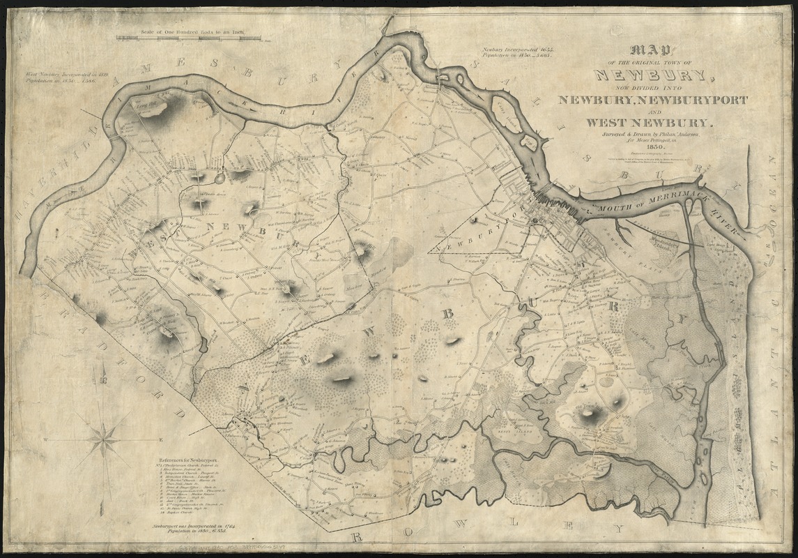
Map of the original town of Newbury, now divided into Newbury, Newburyport and West Newbury
Map of the original town of Newbury, now divided into Newbury, Newburyport and West Newbury
×
Item Information
Title:
Map of the original town of Newbury, now divided into Newbury, Newburyport and West Newbury
Creator:
Anderson, Philander.
Name on Item:
surveyed & drawn by Philanr. Anderson for Moses Pettingell, in 1830.
Date:
1831
Format:
Maps/Atlases
Location:
Boston Public Library
Norman B. Leventhal Map Center
Collection (local):
Norman B. Leventhal Map Center Collection
Series:
Caldwell Collection of Massachusetts Town Plans
Subjects:
Real property--Massachusetts--Newburyport--Maps
Real property--Massachusetts--Newbury--Maps
Real property--Massachusetts--West Newbury (Town)--Maps
Newburyport (Mass.)--Maps
Newbury (Mass.)--Maps
West Newbury (Mass. : Town)--Maps
Places:
Essex (county)
>
Newburyport
Essex (county)
>
Newbury
Essex (county)
>
West Newbury
Extent:
1 map ; 64 x 92 cm.
Permalink:
https://ark.digitalcommonwealth.org/ark:/50959/cj82ks49q
Terms of Use:
No known copyright restrictions.
No known restrictions on use.
Publisher:
[Boston] : Moses Pettingell
Scale:
Scale [1:19,800]. 100 rods = 1 in.
Language:
English
Notes:
Relief shown by shading and hachures.
Shows landowners.
Includes references to points of interest.
Identifier:
06_01_009637
Call #:
G3764.N48 1830 .A53
Barcode:
39999065663849
show more...
View MODS XML
More Like This
Atlas of Essex County, Massachusetts
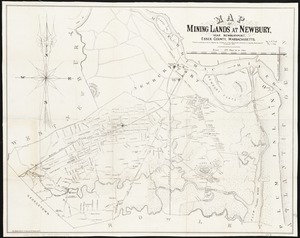
Map of mining lands at Newbury, near Newburyport, Essex County, ...
Plan of Newburyport Mass. from an actual survey
Atlas of the boundaries of the cities of Gloucester and ...
Find More Like This >>
Tools
Share
Facebook
Pinterest
X
Reddit
Tumblr
Email
Copy link
Add to Folder
Questions/Comments
Cite This Item
IIIF Manifest
Downloads
Primary (full resolution, uncompressed)
(TIF, 218 MB)
Large (full resolution)
(JPEG, 18.3 MB)
Medium
(JPEG, 347 KB)
GeoTIFF (georeferenced)
(TIF, 232 MB)