Ensign, Bridgman & Fanning's rail road map of the United States, showing the depots & stations
Ensign, Bridgman & Fannings rail road map of the United States, showing the depots & stations
Item Information
Title:
Ensign, Bridgman & Fanning's rail road map of the United States, showing the depots & stations
Title (alt.):
Rail road map of the United States
Description:
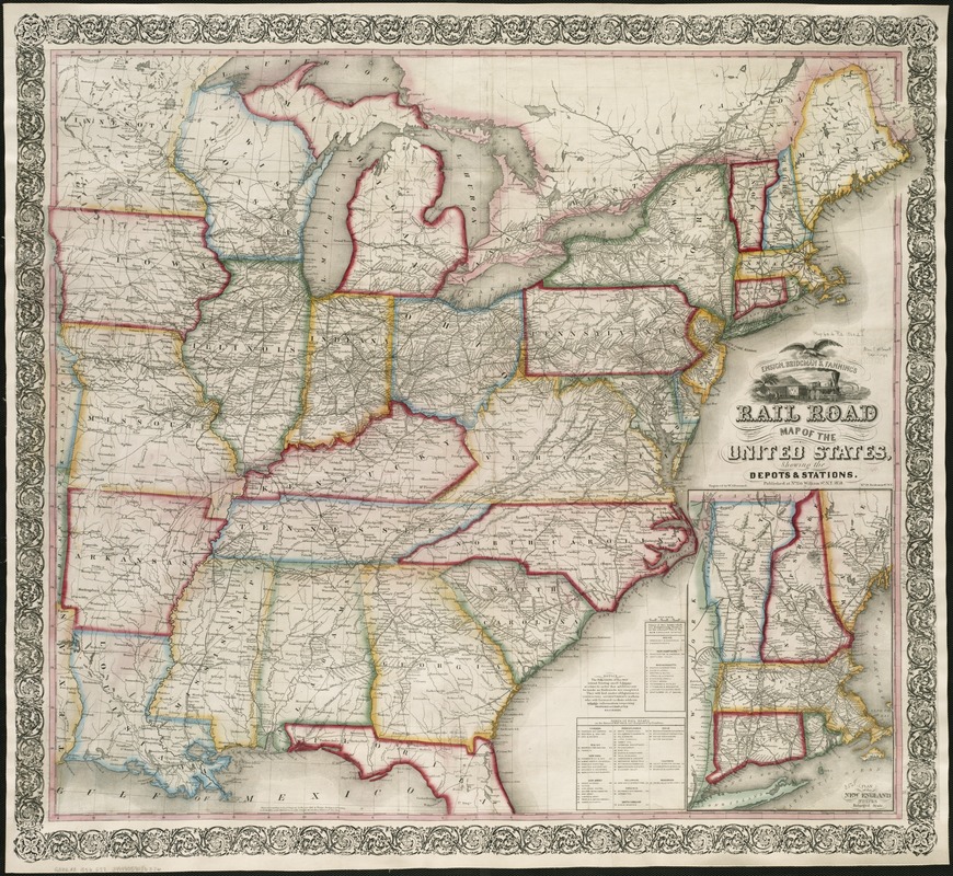
At first glance, this vibrant map depicts a prosperous and unified country, accentuated by a cartouche adorned with an eagle symbolizing national unity. A vignette displays a train and steamboat departing the countryside for the city, suggesting a natural progression of economic development. However, closer examination reveals major regional differences. The North appears as a dense pattern of geographic information, dotted with cities and towns connected by a complex railroad network. By contrast, the rural southern states reflect much less urban development and railroad mileage. These opposing settlement patterns reflected differing ways of life that underlay the frictions threatening to tear the country apart. Two regions that did not share a common economy, culture, or philosophy concerning slavery constituted this divided "nation."
Inset: Plan of the New England states.
Identifies individual railroad lines.
Table lists major railroads.
Cartouche includes contemporary locomotive and train.
Notes (exhibitions):
Exhibited: "Torn in Two: The 150th Anniversary of the Civil War" organized by the Norman B. Leventhal Map Center at the Boston Public Library, 2011.