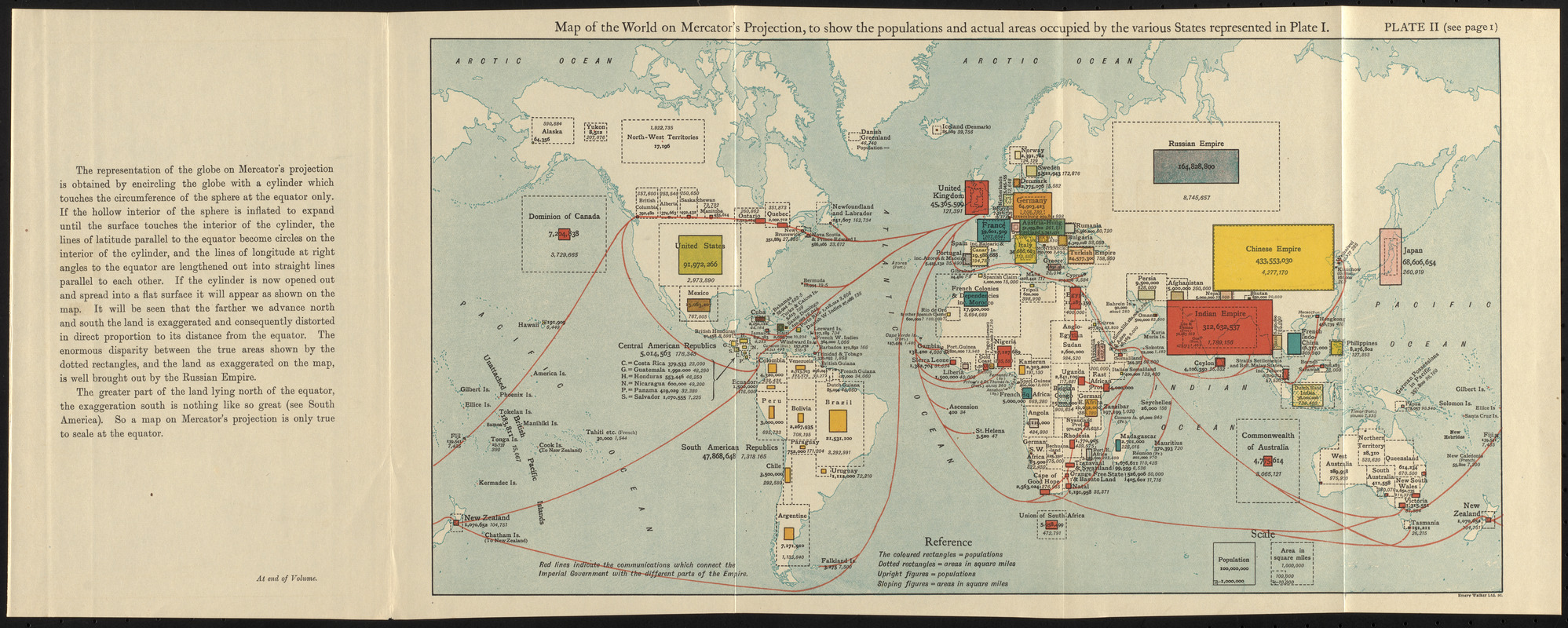
Rectangles representing population size overlaid on a world map.
Areas under the dominion of the British Empire indicated in red.
Also shows communication lines between parts of the British Empire.
Includes text.
Appears in The commonwealth of nations / edited by L. Curtis.
"Plate II (see page I)."
"At end of volume."
Notes (exhibitions):
Exhibited: "Bending lines: maps and data from distortion to deception," organized by the Norman B. Leventhal Map & Education Center at the Boston Public Library, 2020-2021.