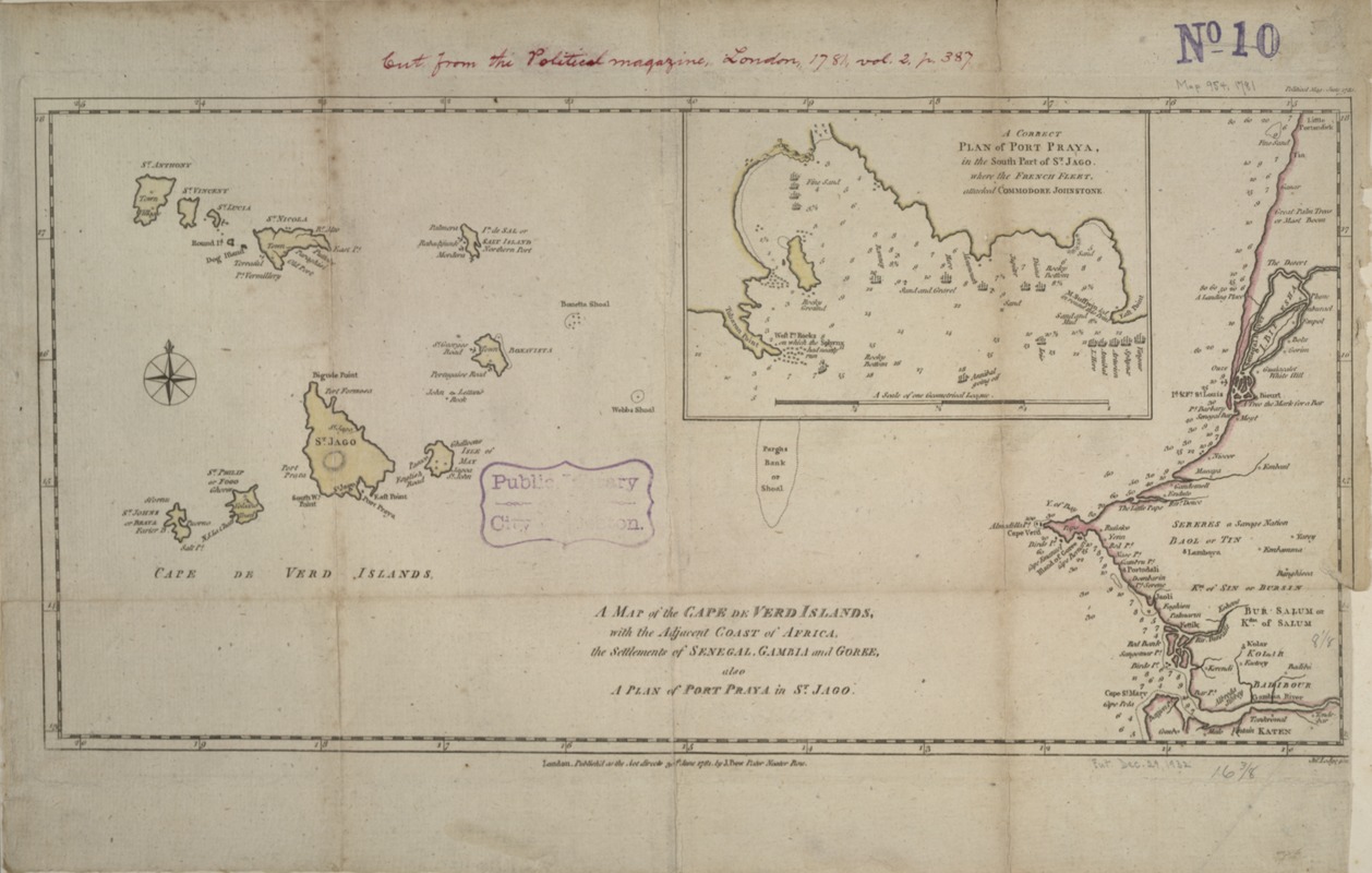
A map of the Cape de Verd Islands with the adjacent coast of Africa, the settlements of Senegal, Gambia and Goree, also a plan of Port Praya in St. Jago
A map of the Cape de Verd Islands with the adjacent coast of Africa, the settlements of Senegal, Gambia and Goree, also a plan of Port Praya in St. Jago
Item Information
Title:
A map of the Cape de Verd Islands with the adjacent coast of Africa, the settlements of Senegal, Gambia and Goree, also a plan of Port Praya in St. Jago
Description:
This map of the Cape Verde islands appeared in the second volume (1781) of "The Political Magazine". Published by John Bew, a London bookseller, this journal was written for an audience of informed gentlemen and often included supplementary maps. The map provides detailed depth soundings along the African coastline and in the inset for Praya Bay. Currently, the town of Praya (Praia), located on the island of St. Jago (Sao Tiago), the largest island in the Cape Verde grouping, serves at the capital of the country which gained its independence in 1975.
Depths shown by soundings.
Appears in The Political Magazine. London. 1781. Vol. 2, p. 387.
Exhibited in “Faces and Places,” at the Boston Public Library, Boston, MA, October 2003 - September 2004 MB (BRL)