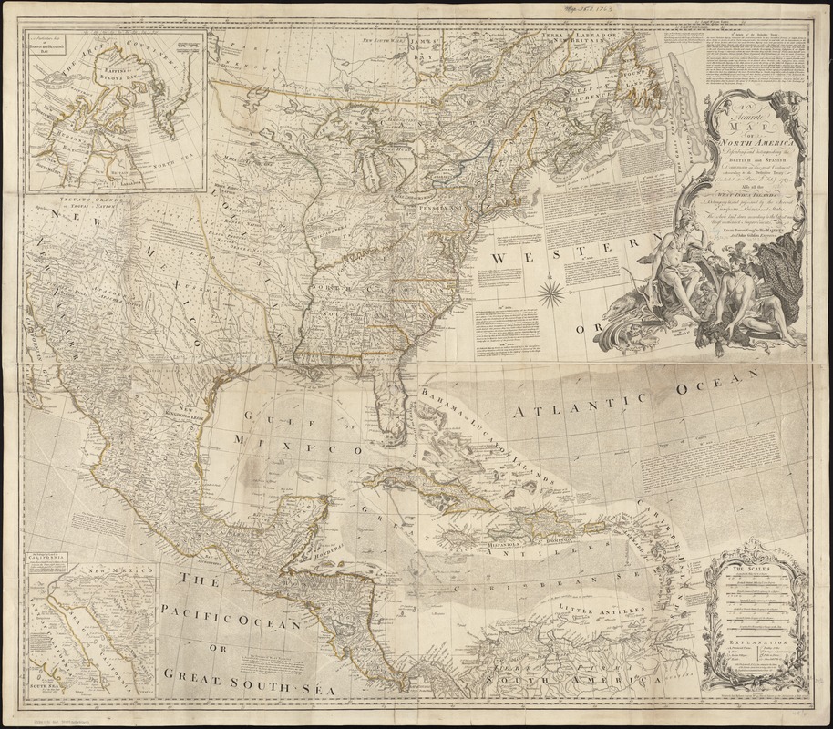
An accurate map of North America : describing and distinguishing the British and Spanish dominions of this great continent; according to the definitive treaty concluded at Paris 10th Feby. 1763 : also all the West India Islands belonging to and possessed by the several European princes and states
An accurate map of North America
Item Information
Title:
An accurate map of North America : describing and distinguishing the British and Spanish dominions of this great continent; according to the definitive treaty concluded at Paris 10th Feby. 1763 : also all the West India Islands belonging to and possessed by the several European princes and states
Prime meridians: London and Ferro.
Relief shown pictorially.
Appears in Thomas Jefferys' American atlas. 1775. No. 5, 6.
Includes historical notes, excerpts from the treaty of 1763, and insets of "A particular map of Baffin and Hudson's Bay," and "The passage by land to California."
Cataloging, conservation, and digitization made possible in part by The National Endowment for the Humanities: Exploring the human endeavor.