Skip to search
Skip to main content
Digital Commonwealth
Sign Up / Log In
Search for
Search
Search
Search
Basic
Advanced
Explore
Map
Collections
Institutions
Formats
For Educators
Primary Source Sets
Lesson Plans
Using Primary Sources
Searching Digital Commonwealth
For Institutions
Join Digital Commonwealth
Conferences, Trainings, & Events
How to Contribute Collections
Digitization Services
Board & Committees
Frequently Asked Questions
About
About Digital Commonwealth
News & Announcements
Copyright & Terms of Use
Harmful Content Statement
Partners
API
Contact Us
Boston Public Library
Norman B. Leventhal Map Center Collection
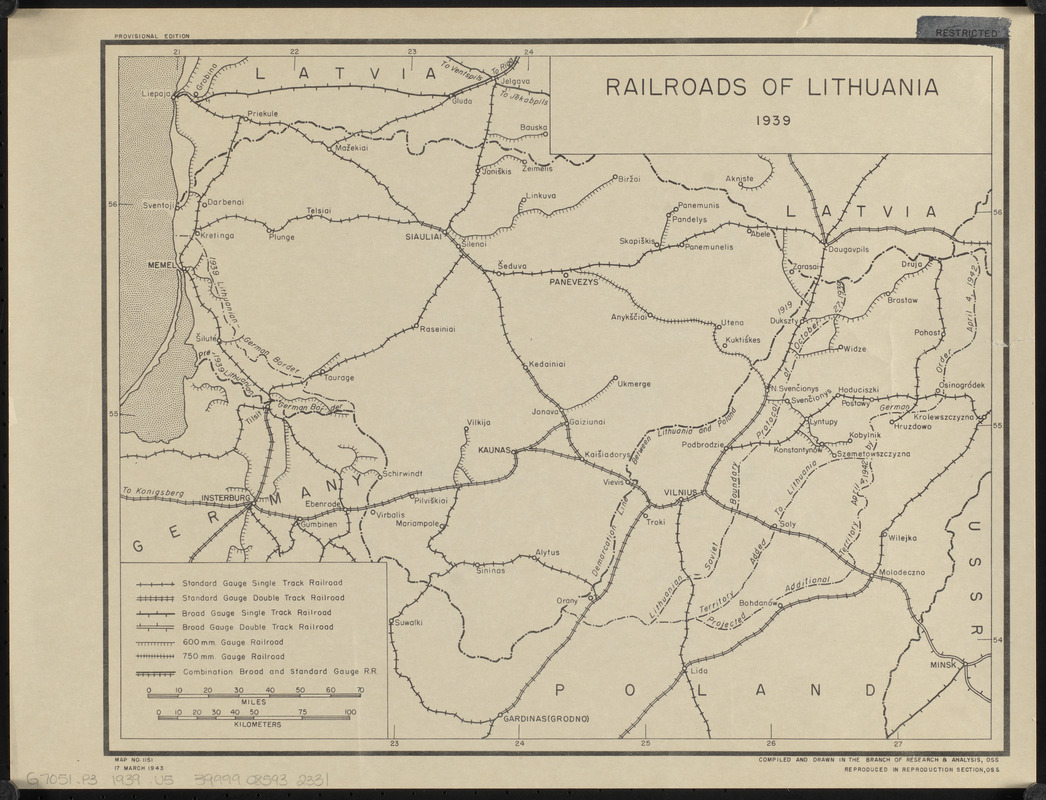
Railroads of Lithuania, 1939
Railroads of Lithuania, 1939
×
Item Information
Title:
Railroads of Lithuania, 1939
Cartographer:
United States. Office of Strategic Services. Research and Analysis Branch
Name on Item:
compiled and drawn in the Branch of Research & Analysis, OSS
Date:
1943
Format:
Maps/Atlases
Location:
Boston Public Library
Norman B. Leventhal Map Center
Collection (local):
Norman B. Leventhal Map Center Collection
Subjects:
Railroads--Lithuania--Maps
Lithuania--Maps
Places:
Lithuania
Extent:
1 map ; 28 x 36 cm
Permalink:
https://ark.digitalcommonwealth.org/ark:/50959/0z709688k
Terms of Use:
No known copyright restrictions.
No known restrictions on use.
Publisher:
[Washington, D.C.?] : Reproduction Section, OSS
Edition:
Provisional edition
Scale:
Scale approximately 1:1,270,000
Language:
English
Notes:
Map no. 1151.
Identifier:
06_01_015145
Call #:
G7051.P3 1939 .U5
Barcode:
39999085932331
show more...
View MODS XML
More Like This
Poland & Lithuania
Poland, shewing the claims of Russia, Prussia & Austria, until the ...
The 100th anniversary map of Abraham Lincoln's visit to ...
1630 shoreline
Find More Like This >>
Tools
Share
Facebook
Pinterest
X
Reddit
Tumblr
Email
Copy link
Add to Folder
Questions/Comments
Cite This Item
IIIF Manifest
Downloads
Primary (full resolution, uncompressed)
(TIF, 29.2 MB)
Large (full resolution)
(JPEG, 2.46 MB)
Medium
(JPEG, 297 KB)