Skip to search
Skip to main content
Digital Commonwealth
Sign Up / Log In
Search for
Search
Search
Search
Basic
Advanced
Explore
Map
Collections
Institutions
Formats
For Educators
Primary Source Sets
Lesson Plans
Using Primary Sources
Searching Digital Commonwealth
For Institutions
Join Digital Commonwealth
Conferences, Trainings, & Events
How to Contribute Collections
Digitization Services
Board & Committees
Frequently Asked Questions
About
About Digital Commonwealth
News & Announcements
Copyright & Terms of Use
Harmful Content Statement
Partners
API
Contact Us
Boston Public Library
Norman B. Leventhal Map Center Collection
/
Maritime Charts and Atlases (Collection of Distinction)
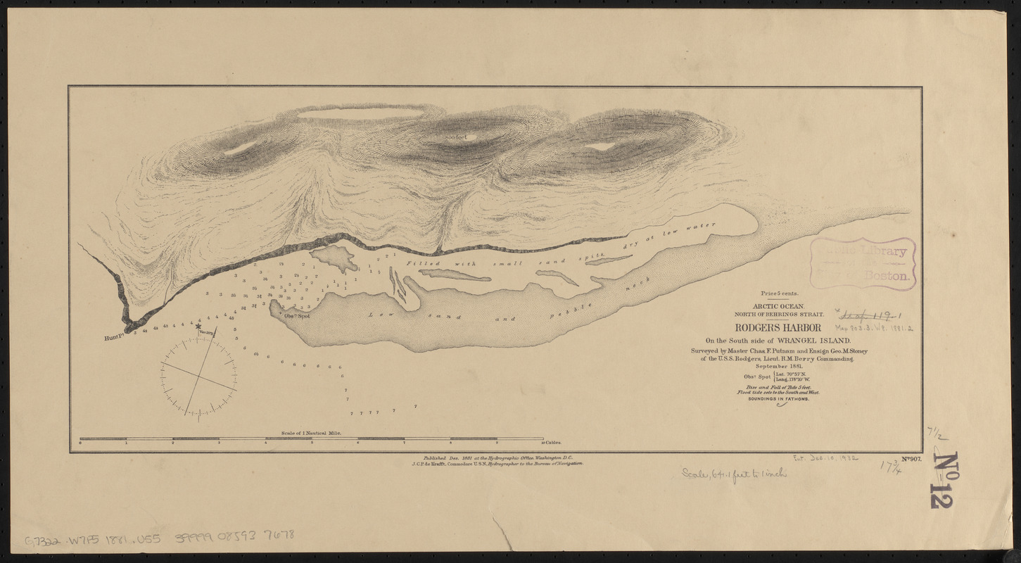
Arctic Ocean, north of Behrings Strait, Rodgers Harbor on the south side of Wrangel Island
Arctic Ocean, north of Behrings Strait, Rodgers Harbor on the south side of Wrangel Island
×
Item Information
Title:
Arctic Ocean, north of Behrings Strait, Rodgers Harbor on the south side of Wrangel Island
Title (alt.):
Rodgers Harbor on the south side of Wrangel Island
Issuing body:
United States. Hydrographic Office
Surveyor:
Putnam, Charles F.
Surveyor:
Stoney, George M., 1852-1905
Name on Item:
surveyed by Master Chas. F. Putnam and Ensign Geo. M. Stoney of the U.S.S. Rodgers, Lieut. R.M. Berry Commanding, September 1881
Date:
1881
Format:
Maps/Atlases
Location:
Boston Public Library
Norman B. Leventhal Map Center
Collection (local):
Norman B. Leventhal Map Center Collection
Subjects:
Nautical charts--Russia (Federation)--Wrangel Island
Wrangel Island (Russia)--Maps
Places:
Russia
>
Wrangel Island
(island)
Extent:
1 map : mounted on linen ; 20 x 45 cm
Permalink:
https://ark.digitalcommonwealth.org/ark:/50959/0z709912v
Terms of Use:
No known copyright restrictions.
No known restrictions on use.
Publisher:
Washington, D.C. : Hydrographic Office
Scale:
Scale approximately 1:7,500
Language:
English
Notes:
Relief shown by hachures and spot heights. Depths shown by soundings.
"No. 907."
"Obsn. spot : Lat. 70⁰57ʹ N, Long. 178⁰10ʹ W."
Identifier:
06_01_015520
Call #:
G9096.P5 svar .U55
Barcode:
39999085937678
show more...
View MODS XML
More Like This
Arctic Ocean, north of Behrings Strait, track of the U.S.S. ...
Arctic Ocean, north of Behrings Strait : Wrangel Island, as ...
The 100th anniversary map of Abraham Lincoln's visit to ...
1630 shoreline
Find More Like This >>
Tools
Share
Facebook
Pinterest
X
Reddit
Tumblr
Email
Copy link
Add to Folder
Questions/Comments
Cite This Item
IIIF Manifest
Downloads
Primary (full resolution, uncompressed)
(TIF, 33.6 MB)
Large (full resolution)
(JPEG, 2.82 MB)
Medium
(JPEG, 289 KB)