Skip to search
Skip to main content
Digital Commonwealth
Sign Up / Log In
Search for
Search
Search
Search
Basic
Advanced
Explore
Map
Collections
Institutions
Formats
For Educators
Primary Source Sets
Lesson Plans
Using Primary Sources
Searching Digital Commonwealth
For Institutions
Join Digital Commonwealth
Conferences, Trainings, & Events
How to Contribute Collections
Digitization Services
Board & Committees
Frequently Asked Questions
About
About Digital Commonwealth
News & Announcements
Copyright & Terms of Use
Harmful Content Statement
Partners
API
Contact Us
Boston Public Library
Norman B. Leventhal Map Center Collection
/
Urban Maps (Collection of Distinction)
/
Boston and New England Maps (Collection of Distinction)
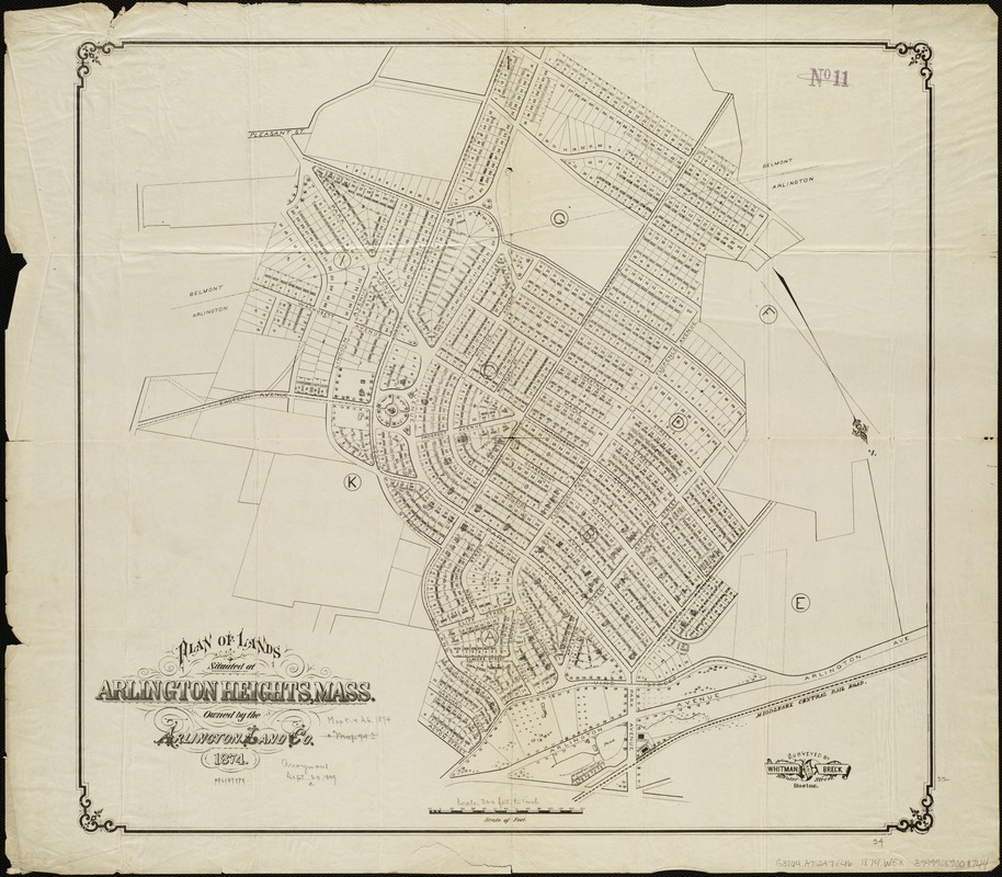
Plan of lands situated at Arlington Heights, Mass : owned by the Arlington Land Co
Plan of lands situated at Arlington Heights, Mass
×
Item Information
Title:
Plan of lands situated at Arlington Heights, Mass : owned by the Arlington Land Co
Creator:
Whitman & Breck
Name on Item:
surveyed by Whitman & Breck.
Date:
[1874]
Format:
Maps/Atlases
Location:
Boston Public Library
Norman B. Leventhal Map Center
Collection (local):
Norman B. Leventhal Map Center Collection
Subjects:
Real property--Massachusetts--Arlington--Maps
Arlington Heights (Mass.)--Maps
Places:
Middlesex (county)
>
Arlington
Extent:
1 plan ; 56 x 61 cm.
Permalink:
https://ark.digitalcommonwealth.org/ark:/50959/1257bb39n
Terms of Use:
No known copyright restrictions.
No known restrictions on use.
Publisher:
Boston : Heliotype
Scale:
Scale 1:3,840.
Language:
English
Notes:
Oriented with north toward the lower right.
Notes (date):
This date is inferred.
Identifier:
06_01_005107
Call #:
G3764.A7:2A7G46 1874 .W5x
Barcode:
39999059009744
show more...
View MODS XML
More Like This
Atlas of the towns of Watertown, Belmont, Arlington and Lexington, ...
Plan of building lots on the "Kimball" Estate Arlington, Mass. ... ...
The 100th anniversary map of Abraham Lincoln's visit to ...
1630 shoreline
Find More Like This >>
Tools
Share
Facebook
Pinterest
X
Reddit
Tumblr
Email
Copy link
Add to Folder
Questions/Comments
Cite This Item
IIIF Manifest
Downloads
Primary (full resolution, uncompressed)
(TIF, 160 MB)
Large (full resolution)
(JPEG, 13.4 MB)
Medium
(JPEG, 254 KB)
GeoTIFF (georeferenced)
(TIF, 128 MB)