Skip to search
Skip to main content
Digital Commonwealth
Sign Up / Log In
Search for
Search
Search
Search
Basic
Advanced
Explore
Map
Collections
Institutions
Formats
For Educators
Primary Source Sets
Lesson Plans
Using Primary Sources
Searching Digital Commonwealth
For Institutions
Join Digital Commonwealth
Conferences, Trainings, & Events
How to Contribute Collections
Digitization Services
Board & Committees
Frequently Asked Questions
About
About Digital Commonwealth
News & Announcements
Copyright & Terms of Use
Harmful Content Statement
Partners
API
Contact Us
Boston Public Library
Norman B. Leventhal Map Center Collection
A map of the icy sea in which the several communications with the land waters and other new discoveries are exhibited
A map of the icy sea in which the several communications with the land waters and other new discoveries are exhibited
×
Item Information
Title:
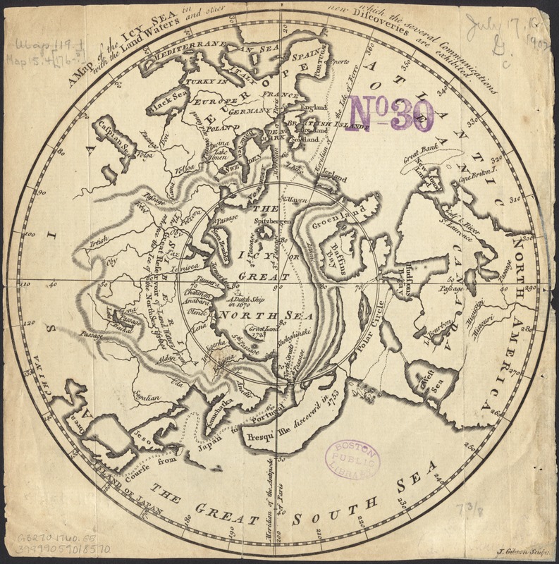
A map of the icy sea in which the several communications with the land waters and other new discoveries are exhibited
Creator:
Gibson, J. (John), fl. 1750-1792
Name on Item:
J. Gibson, sculpt.
Date:
[1760]
Format:
Maps/Atlases
Location:
Boston Public Library
Norman B. Leventhal Map Center
Collection (local):
Norman B. Leventhal Map Center Collection
Subjects:
Arctic regions--Maps--Early works to 1800
North Pole--Maps--Early works to 1800
Places:
Arctic
(area)
Extent:
1 map : col. ; 19 cm. in diam., on sheet 21 x 22 cm.
Permalink:
https://ark.digitalcommonwealth.org/ark:/50959/2514p060z
Terms of Use:
No known copyright restrictions.
No known restrictions on use.
Publisher:
London : Gentleman's Magazine
Scale:
Scale not given.
Language:
English
Notes:
From: Gentleman's magazine, v.30, June 1760 opp. p. 284.
Polar projection showing the "icy great North Sea" south to mid Asia and America.
Notes (date):
This date is inferred.
Identifier:
06_01_005923
Call #:
G3270 1760 .G5
Barcode:
39999059018570
show more...
View MODS XML
More Like This
A map of the North Pole with all the territories that lye near it, ...
Poli Arctici, et circumiacentium terrarum descriptio novissima
Carte particuliere de l'Amerique septentrionale ou sont compris le ...
Pascaarte vande Noorder Zee custen van America, vande West-hoeck ...
Find More Like This >>
Tools
Share
Facebook
Pinterest
X
Reddit
Tumblr
Email
Copy link
Add to Folder
Questions/Comments
Cite This Item
IIIF Manifest
Downloads
Primary (full resolution, uncompressed)
(TIF, 29.2 MB)
Large (full resolution)
(JPEG, 2.45 MB)
Medium
(JPEG, 300 KB)