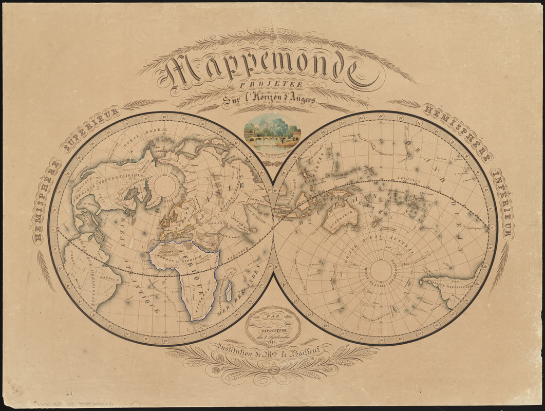
Women in Cartography: This student map depicts the world in a double-hemisphere, centering the left half on Angers, France, and the right on its antipode, or opposite point on earth. Drawn by a French girl in 1839, this thoughtfully conceived map includes two colored views and extensive calligraphy in a fine hand. The unusual elliptical design places the northern and southern borders meshing with the two hemispheres for a unique overall presentation of the world, most likely based on a similar map from an early 19th-century French world atlas.
Manuscript map by a schoolgirl attending the institution of Madamoiselle Le Bailleul in Angers. Double hemisphere map depicts a northern hemisphere centered on Angers and a southern hemisphere centered on Angers' antipode. Includes a colored view of Beaupréau.
Relief shown pictorially.
Inset: Vue de Beaupreau.
"Exposition du 2 Septembre 1839."
"Institution de Melle. Le Bailleul."
Notes (exhibitions):
Exhibited: "Women in Cartography: Five Centuries of Accomplishments" organized by the Norman B. Leventhal Map Center at the Boston Public Library, 2015-2016.