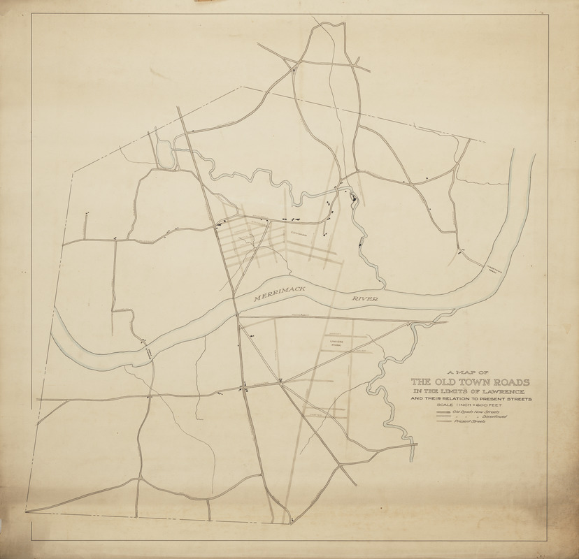
A map of the old town roads in the limits of Lawrence and their relation to present streets
A map of the old town roads in the limits of Lawrence and their relation to present streets
Item Information
Title:
A map of the old town roads in the limits of Lawrence and their relation to present streets
Description:
This map is paper on canvas framed by a wooden dowel on the bottom end and a piece of molding on the top. There is red tape on the back making a loop so it could be hung. The scale is 1 inch to 600 feet and a key explains old roads now streets, old roads now discontinued, and present streets.