Skip to search
Skip to main content
Digital Commonwealth
Sign Up / Log In
Search for
Search
Search
Search
Basic
Advanced
Explore
Map
Collections
Institutions
Formats
For Educators
Primary Source Sets
Lesson Plans
Using Primary Sources
Searching Digital Commonwealth
For Institutions
Join Digital Commonwealth
Conferences, Trainings, & Events
How to Contribute Collections
Digitization Services
Board & Committees
Frequently Asked Questions
About
About Digital Commonwealth
News & Announcements
Copyright & Terms of Use
Harmful Content Statement
Partners
API
Contact Us
Boston Public Library
Norman B. Leventhal Map Center Collection
Rand, McNally & Co.'s California
Rand, McNally & Co.s California
×
Item Information
Title:
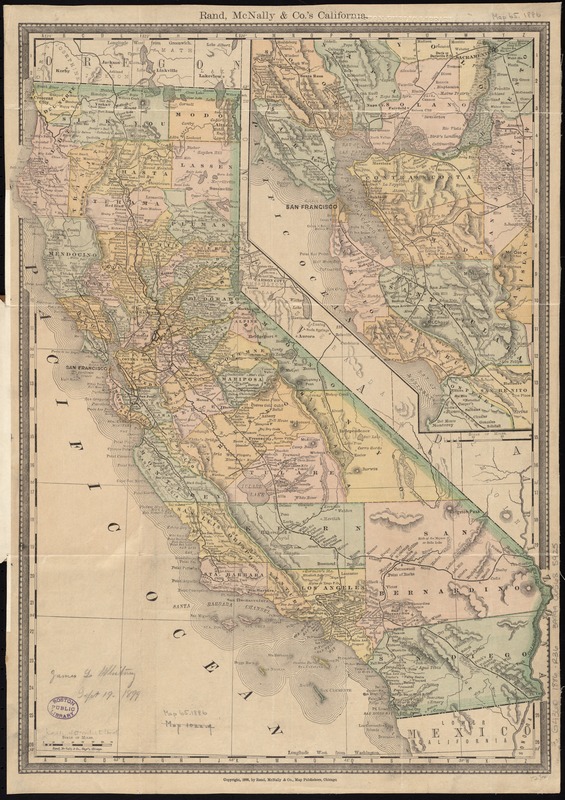
Rand, McNally & Co.'s California
Creator:
Rand McNally and Company
Date:
1886
Format:
Maps/Atlases
Location:
Boston Public Library
Norman B. Leventhal Map Center
Collection (local):
Norman B. Leventhal Map Center Collection
Subjects:
California--Maps
Places:
California
Extent:
1 map : col. ; 47 x 34 cm., folded in cover 18 x 11 cm.
Permalink:
https://ark.digitalcommonwealth.org/ark:/50959/4m90fc277
Terms of Use:
No known copyright restrictions.
No known restrictions on use.
Publisher:
Chicago : Rand, McNally & Co.
Scale:
Scale [ca. 1:2,550,000]
Language:
English
Notes:
Relief shown by hachures.
Inset: [San Francisco and vicinity].
BPL copy lacking front cover.
Identifier:
06_01_011408
Call #:
G4360 1886 .R36
Barcode:
39999065685925
show more...
View MODS XML
More Like This
Fault map of the state of California
Geographical, topographical, state highway and railroad map of ...
Map of California and Nevada
Map of California and Nevada
Find More Like This >>
Tools
Share
Facebook
Pinterest
X
Reddit
Tumblr
Email
Copy link
Add to Folder
Questions/Comments
Cite This Item
IIIF Manifest
Downloads
Primary (full resolution, uncompressed)
(TIF, 61.5 MB)
Large (full resolution)
(JPEG, 5.16 MB)
Medium
(JPEG, 223 KB)
GeoTIFF (georeferenced)
(TIF, 95.4 MB)